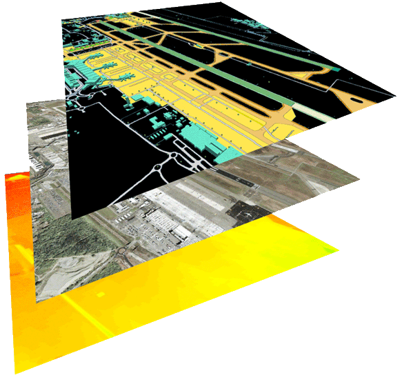
Airport operations have become a complex combination of multiple activities performed by many individuals including pilots, air traffic and apron controllers, surface vehicle operators, maintenance crews, and others. Geospatial data has come to play an important role in airport operations and management. The TrueTerrain™ airport operations bundle stack of multilayered solutions from L3Harris Geospatial is designed to provide a multi-use collaborative working dataset to supplement surface navigation. Layers include correlated imagery, elevation data, and aerodrome mapping databases (AMDBs).
One of L3Harris Geospatial’s key customers of the TrueTerrain™ airport operations bundle stack is SLC Associates, a leading provider of aeronautical data and aerodome surveys in over 34 countries. They use the dataset for a variety of activities including internal quality assurance. L3Harris’ products are bundled along with SLC-created surveys and delivered to airport authorities, allowing airports to fulfill their obligations to provide Electronic Terrain and Obstacle Data (eTOD) and ensure safe and efficient operations within the aerodrome.
The creation of TrueTerrain™ airport operations bundle stack products begins with a search for high-resolution optical stereo data over the defined area of interest (AOI). Timeliness of source imagery is essential for providing a current representation of the airport, and when archive data is not recent enough to meet requirements, we work with multiple imagery vendors to task and collect new stereo imagery.
Stereo scenes are triangulated using survey-quality ground control points through triangulation software. The resulting precise registration of the stereo data becomes the basis for geolocation of the TrueTerrain™ airport operations bundle stack.
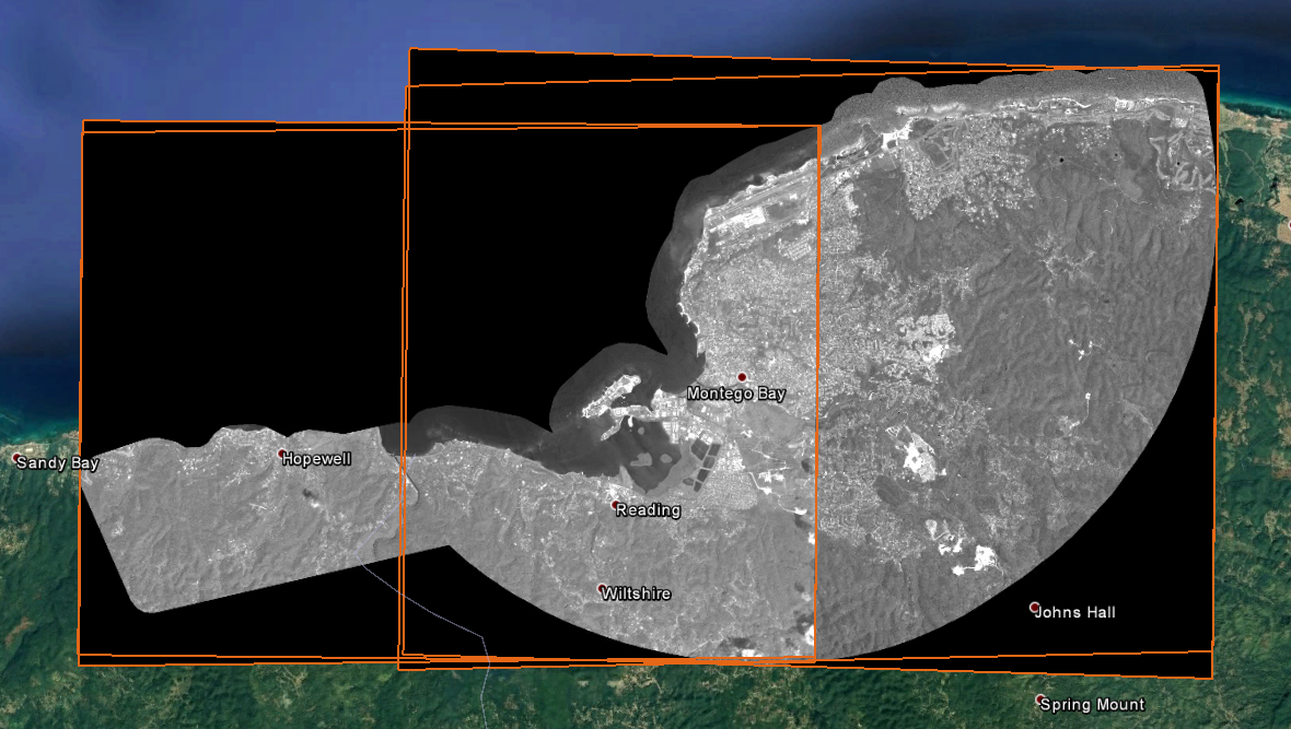
Pleiades Stereo Imagery (Courtesy of Airbus)
PROCESSING MADE PERFECT
Using previously triangulated stereo scenes, TrueTerrain™ high-resolution (50cm) mosaics are orthorectified and adjusted using advanced processing techniques including pan-sharpening, atmospheric correction, tonal balancing, and cloud-removal to achieve a product recognized for its seamless, natural color.
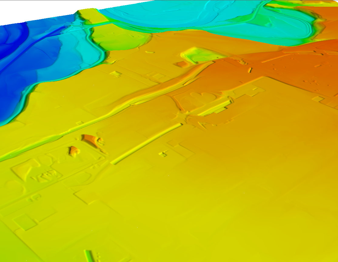
Digital Terrain Model (DTM)
Highly accurate engineering grade bare earth digital terrain models (DTMs) are created using automated mass points and three dimensional breaklines. High-fidelity digital surface models (DSMs) are generated to precisely capture surface features.
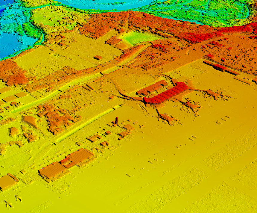
Digital Surface Model (DSM)
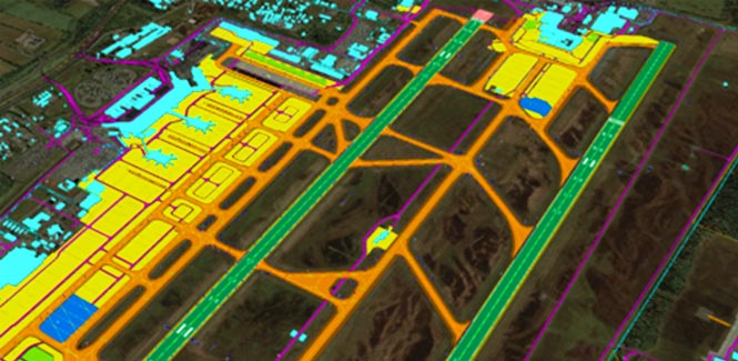
AMDBs are vector layers that are key airport features digitized from the georeferenced imagery, resulting in location-specific point, line, and polygon vector feature classes. Detailed attributes are added to the vector objects using image interpretation, publicly available airport diagrams, and customer provided data. This attribution provides additional information beyond the spatial location, allowing the user to have access to specific details relating to characteristics and function of the aerodrome features.
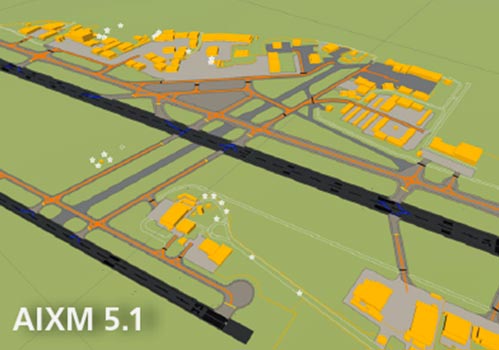
AMDB vector layers are provided in shapefile format. Supported layers also available in AIXM and AMXM schemas.
These geospatial data products are precisely correlated and registered to real-world surveys, with typical resulting CE90 accuracies of 1m or less for 50cm imagery products. Accuracy assessment of 5m DTM and 2m DSM Elevation products have yielded a typical LE90 of 1m or less for Z-values.
Along with providing TrueTerrain Airport Bundle Stack products, L3Harris Geospatial has decades of experience providing geospatial solutions for government and commercial customers within the visual simulation and mapping industries. L3Harris’ multi-layer TrueTerrain bundle stack solutions include correlated imagery, elevation, vectors, 3D models, classification maps, and FGDC-compliant metadata. Our experienced staff of imagery scientists and analysts employ a customer-centric, solution-oriented approach, using advanced tools, algorithms and photogrammetric techniques to produce a suite of geospatial products with diverse commercial and military specifications.
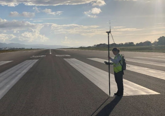
Surveying Ground Control Points (Courtesy of SLC Associates)
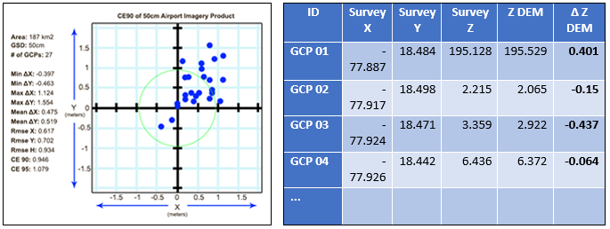
Example Accuracies of Airport Imagery and Elevation Products