The Earth’s climate is rapidly changing and few areas on the planet have been left untouched. Modeling and predicting how these changes will affect coastal areas and population centers is a rapidly evolving science. The U.S. Department of Defense (DoD) has been looking into how extreme weather (precipitation and drought) may affect U.S. armed forces stationed overseas and recently enlisted the help of the L3Harris Geospatial Data Products team to aid in their study.
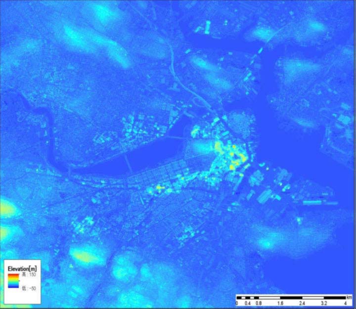
AW3D Standard 2.5 m DEM of Boston Harbor with the darker tones for low elevations / sea level, and brighter objects are raised e
In September 2020, the Data Products team provided 2.5 m Digital Terrain Model (DTM) data to their DoD partner. The DoD is using tools that were developed by the seven national labs to model various climate scenarios and the effects of flood inundation caused by extreme weather events and sea level rise. They are in the process now of analyzing scenarios for the years 2050 and 2085 and will derive flood inundation layers for the U.S. overseas bases. This work has already been completed for 500 CONUS sites. The total area covered in the provided data was 32,584 sq. km including more than 50 sites around the world.
The key to this type of modeling is a good quality and reliable Digital Elevation Model (DEM). It was determined that the ideal data for this work was the AW3D Standard 2.5 m resolution DTM. AW3D Standard is a DTM data that is derived from a multilayer stack of PRISM data acquired by the Advanced Land Observing Satellite (ALOS) from the Japan Aerospace Exploration Agency (JAXA) using a multi-view photogrammetric mapping process.
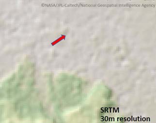
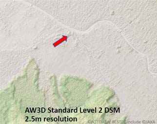
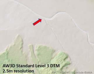
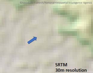
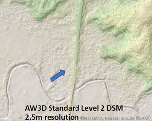
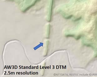
SRTM vs. AW3D
| 
| 
|
| 
| 
|
The above are hill shade models of DEM data showing the differences in level of detail between the public-domain (free) SRTM 30 m DEM data and the AW3D Standard 2.5 m DEM. The DOD partner was looking for a source of DEM data that was better quality than the SRTM data for their modeling but also affordable and AW3D fit the bill.
The DTM is a bare-earth elevation model of natural terrain features where elevations of vegetation and cultural features, such as buildings and other manmade structures, are digitally removed. The DTM is hydro-enforced to ensure structures over water bodies (such as bridges and culverts) are removed, lake water surfaces are flattened, and watercourses flow downstream. In critical areas where ALOS coverage was found to be insufficient to produce a good quality 2.5 m DTM product, or there were voids in the data, these areas we in-filled using a product called AW3D Enhanced DTM. AW3D Enhanced DTM is derived from a deep stack of Maxar 0.5 m high-resolution satellite imagery using a process that is similar to how AW3D Standard is produced.
If you are looking for quality data products to perform climate change modeling or for some other project, look no further than L3Harris Geospatial. Contact our experts and they can work with you to help determine the best data to meet your project objectives.