Due to the changing nature of a mine site, many of L3Harris’ mining customers monitor their locations using regularly updated satellite imagery. The imagery is used as a method to track the progress of the mine and help with environmental recovery, future planning and in some cases, detect signs of minerals.
When considering which imaging sensor to use, it is important to understand the resolution of the sensor which is defined with spatial, temporal, spectral and radiometric resolutions. Spatial resolution is a measurement of how much detail is captured in the image based on pixel size. The smaller the spatial resolution, the more detail is represented. Mine monitoring can be done at a variety of spatial resolutions from 0.3m up to 3m per pixel resolution, depending upon the detail needed.
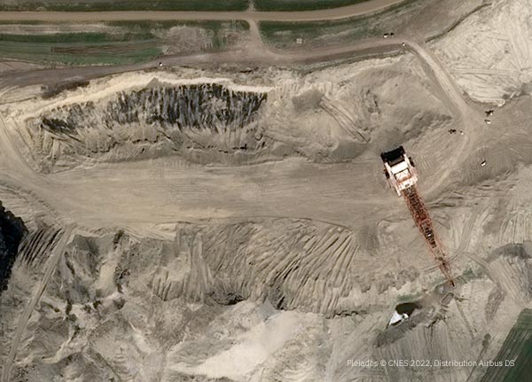
50cm resolution view from space of an open pit mine in North America.
Temporal resolution, the time between captured images of the same location, is also important. Most mining companies choose a quarterly update while others have a more tailored collection schedule that is used to document annual milestones for mine inspections or assessments. Others may select to use a mix of resolutions and scheduled collections. High resolution and more detailed data are used in efforts to track existing activity. Lower detail and less frequently collected imagery is used to help plan future expansions and track environmental recovery in previously mined and reclaimed areas.
The spectral resolution of imagery is important because it is used to identify features at varying spectral wavelengths. Specific bands of imagery outside the visible spectrum can be used to detect certain minerals on the surface. Short Wave Infrared (SWIR) bands have proven beneficial in detecting surface minerals.
While satellite imagery lacks the ability to penetrate the earth to detect subterranean minerals, the occurrences of certain minerals on the surface have been known to indicate the presence of gems and other minerals beneath. The one exception to the lack of penetration is the ability of the Infrared band to see a few meters into bare sand to detect stone. While this can be very beneficial to fields such as Egyptology and archaeology, there are cases where it is useful to traditional mining as well.
The radiometric resolution represents the sensor’s ability to differentiate the number of gray values that are captured in an image. These values are measured in bits. The higher the bits of imagery, the larger the range of values and the better the surfaces can be distinguished. The radiometric resolution of satellite images ranges from 8 bit to 16 bit.
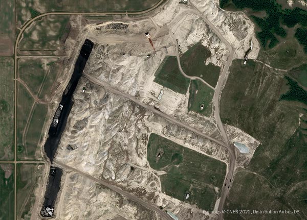
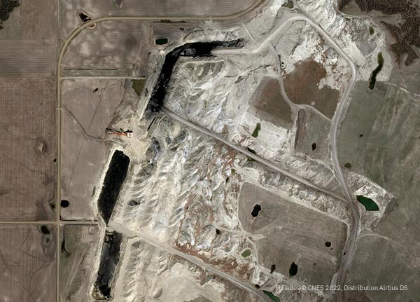
Regular Image collections over time show changes and progress in mining.
In addition to imagery, Digital Terrain Models (DTMs) are a geospatial data layer that offers several benefits to mining. DTMs are high-detail elevation models that are 3D representations of the bare-earth surface. It is very crucial to create quality elevation models to capture details for mining applications.
Utilizing high resolution stereo satellite imagery, DTMs of the mines can be created using photogrammetry-derived or algorithm-derived processes. These elevation models are used for planning, spatial awareness and tracking of volumetric changes, as well as other detailed changes of the mining area. Slightly different data collection and additional time is needed to create elevation mining data.
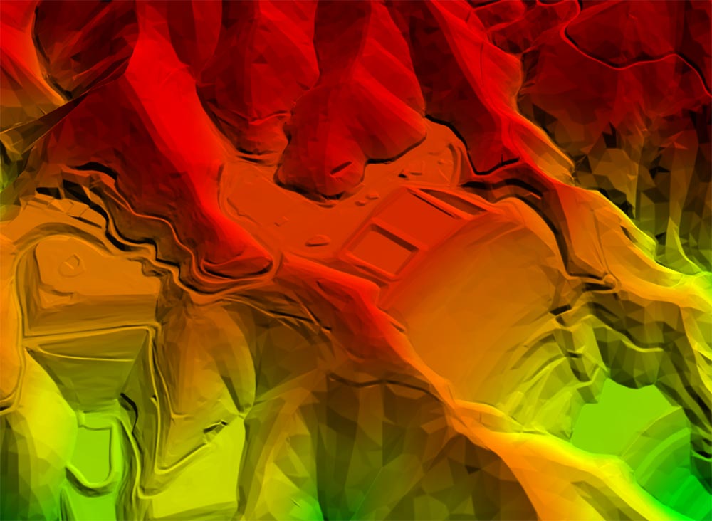
Photogrammetry-derived 1m DTM Elevation Model created from Maxar satellite imagery
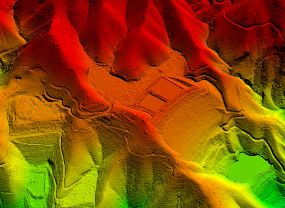
Algorithm-derived 1m DTM Elevation Model created from Maxar satellite imagery
Survey-quality Ground Control Points (GCPs) can be used in the process to register stereo data for precise location of imagery and elevation data. GCPs are an option to consider when defining the scope of a project.
L3Harris is an unbiased consultant, identifying the right data to solve customer’s problems and meet specific project requirements. Email us at GeospatialData@L3Harris.com with a KMZ or similar outline file along with the frequency of collection you desire, any band requirements for your mine site, and any questions and we will be happy to help you monitor your mine site. In addition, L3Harris provides the world’s leading image analytics to analyze your imagery as well as monitoring services if you need insights or answers related to area(s) of interest – email GeospatialInfo@L3Harris.com to discuss.