
Today, DEMs are usually generated from remotely sensed data sets collected either from an aircraft (airplane, helicopter or unmanned aircraft / drone) or spacecraft (satellite or Space Shuttle). One of three types of digital sensors typically collect data that can be used to derive elevation measurements – optical imaging sensor (frame camera / push broom scanner), synthetic aperture radar (SAR) sensor, or laser scanner (also called LIDAR) sensors. These technologies are dramatically different from one another.
Vexcel UltraCam aerial mapping camera mounted under airplane fuselage used to collect overlapping/stereo precision digital aerial imagery. Courtesy Vexcel Imaging.
LIDAR data is most often gathered by aircraft (including drones), while optical sensors can be carried by satellites, airplanes, helicopters and drones. Due to their relatively large size, SAR systems usually operate on larger aircraft or satellites, not drones or small aircraft.
The process used to extract elevation values from optical images is called photogrammetry, and it was developed over a century ago to create topographic maps and later DEMs from overlapping aerial photographs. In manual photogrammetry, a technician views overlapping images called stereo pairs, which present the surface terrain three dimensionally to the photogrammetrist, allowing for direct measurement of elevation values of ground features and referenced with the help of ground control survey points (GCPs). Elevations under dense canopy and obscured locations are interpolated. Photogrammetric mapping is still widely used today but the process is now entirely digital and semi-automated.
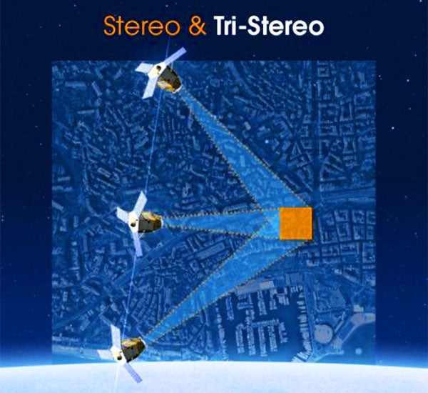
Stereo imagery collected from high-resolution optical sensor satellites. Courtesy Airbus Defense and Space.
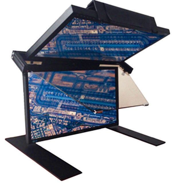
Digital photogrammetric workstation. Courtesy of DAT/EM Systems International.
The benefit of photogrammetrically extracting elevations from photographs is there is a direct correlation between features seen on the photos and the actual measurements. This means technicians can easily and precisely capture, for example, the edges of drainage curbs, utility poles, and building roofs, etc., to generate 3D points or lines in the digital map. Similarly, geomorphological features can be clearly defined such as ridgelines, drainages, etc., which are all very important for hydrological engineering. The downside of stereo-photogrammetric mapping is the added expense of acquiring ground control point survey, and the process can be time consuming.
A new take on photogrammetry, called Multi-View Photogrammetric Processing, is now being applied by a Japanese geospatial services company called NTT Data and Restec and offered through Harris Corp. Rather than traditional along-track stereo image collection from satellite, this process utilizes a deep stack of eight or more existing or archived satellite images of an area, acquired from many different angles, to extract DEM data products with high accuracy.
The second DEM creation technology is LiDAR or laser scanning. As the name implies, this active system uses a laser to emit tens of thousands of light pulses from the bottom of the aircraft at the Earth below. These light beams strike ground and surface features before bouncing back to the device where calculations determine the precise time, and therefore range or distance, between surface points and the aircraft. Precise positional data of the airborne sensor platform from onboard GPS and inertial measurement units, which measure the attitude (pitch, roll, and yaw) of the aircraft, are critical for the calculation of precise x, y, z point measurements.
LIDAR mapping is efficient at quickly mapping relatively large areas, such as cities or counties, and the devices can be operated any time day or night. The single most important advantage of laser scanning is that every elevation point is measured directly. Modern LIDAR units are powerful enough to hit the ground with laser pulses separated by just a few centimeters, resulting in a very accurate representation of the terrain. The only significant downside of LIDAR is that the resulting dense point cloud of x, y, z measurements is difficult to interpret and identify specific ground features and extract measurements from them, compared to optical photogrammetric image mapping, which can identify specific features on the terrain.
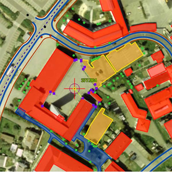
Resulting DEM and planimetric feature map derived from stereo aerial image data.
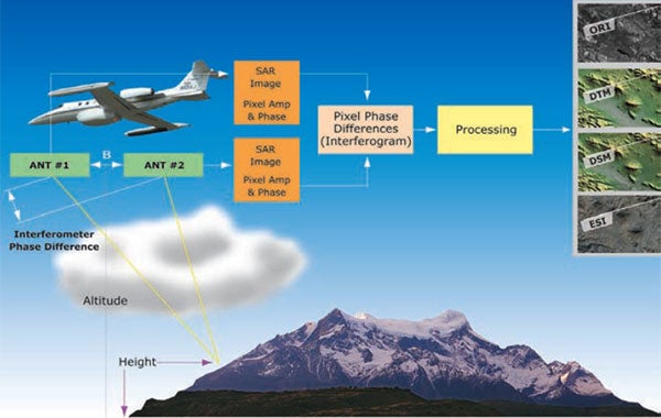
IFSAR (Interferometric Synthetic Aperture Radar) mapping is another active sensing data collection technology in which radar pulses, typically X-band, are emitted from the spacecraft or aircraft down toward the Earth’s surface. These radar signals reflect off the surface and return valuable information content to a receiving antenna. The phase difference measured in the return signal yields accurate x, y and z measurements of surfaces and features. Elevation mapping with SAR technology is often called InSAR or IFSAR mapping.
Harris Geiger LIDAR mapping system with resulting DEM of Grand Canyon.
SAR sensors can be operated in any weather or lighting conditions, which means it is extremely useful in capturing elevation data in tropical regions where cloud cover is persistent and at latitudes where darkness is pervasive for long periods of the year. While SAR typically delivers medium- to coarse-resolution data sets, it can acquire data quickly and cost-effectively over large regions, including entire countries or regional size areas.


