In just over a decade since its debut, the L3Harris WESCAM MX™-10 electro-optical and infrared (EO/IR) system has changed and expanded the way our airborne law enforcement and other customers use the technology across air, land and maritime domains.
Prior to the introduction of the WESCAM MX™-10, the Airborne Law Enforcement (ALE) market relied on a single supplier who offered simple gimbal technology – a 2-axis turret without a passive isolator and with an external inertial measurement unit (IMU).
The WESCAM MX-10 innovated that ALE market by adapting L3Harris’ core, field-proven technology from larger, more complex products. This smaller, capable and affordable commercial sensor system incorporates concepts from the larger WESCAM MX-15 and -20 products, including a 4-axis turret with an internal passive isolator and an optical bench-mounted IMU. Adaptable and versatile, the MX-10 delivers industry-leading operational effectiveness and reliability.
The ALE market was eager to use augmented reality (AR) moving systems to overlay street names and other geographical information dynamically onto live video. AR systems became the moving map of choice for ALE operators. Those systems require close registration between the map and the video, which in turn, requires accurate and stable geo-pointing performance from the sensor. The WESCAM MX-10 uniquely delivers the geo-pointing performance required by AR moving maps in its size class.
The system provides the best target detection, recognition, and identification (DRI) range performance in its class, as well as the most accurate and stable target geo-location performance. This is a function of the cameras themselves, as well as the stabilization performance of the gimbal.
Price competitive in the demanding ALE market space, the WESCAM MX-10 gained a loyal following given performance, reliability and support benefits customers experienced over time. From patrol to search and rescue, surveillance to fire assist and anti-poaching missions, the benefits and versatility of the system supports the important work performed by the operators in making the world a safer place for people and wildlife alike. See more in the Best of WESCAM MX-10 video below.
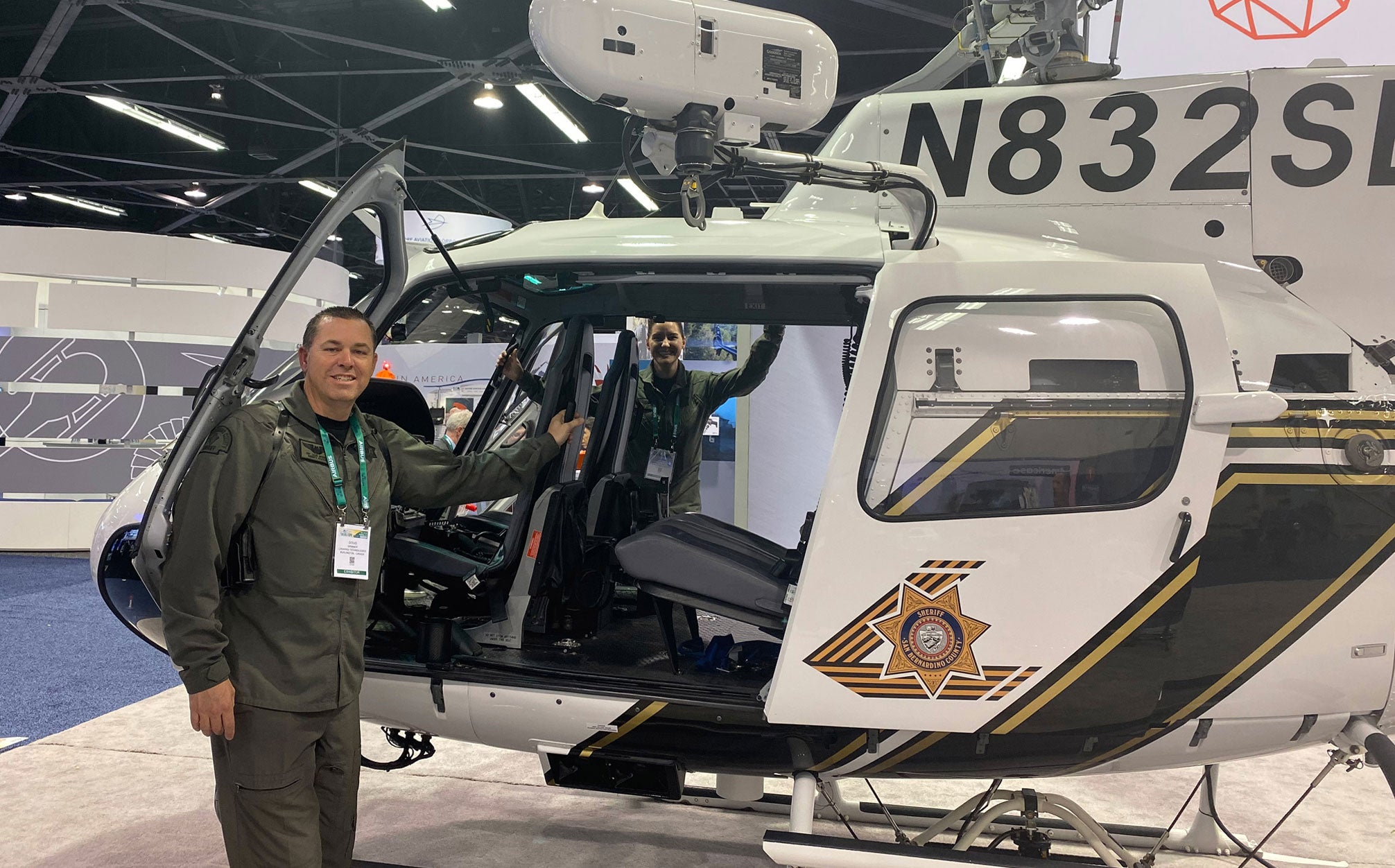
“L3Harris products have helped me in burglaries and robberies, day and night foot pursuits, weapons locations, stolen vehicle confirmation, and added protection for units on approach,” said Deputy Sheriff/Pilot Doug Brimmer of the San Bernardino County Sheriff’s Department. “When there is a scheduled protest, we can use the camera system, including the additional zoomed-in lens, from a further vantage point. We can then use the downlink system to broadcast our video feed to a fixed or handheld waypoint. In terms of search and rescue, we locate hikers in valleys, mountains and in the desert. We have located a plane crash at night thanks to IR picking up heat from the engine.”
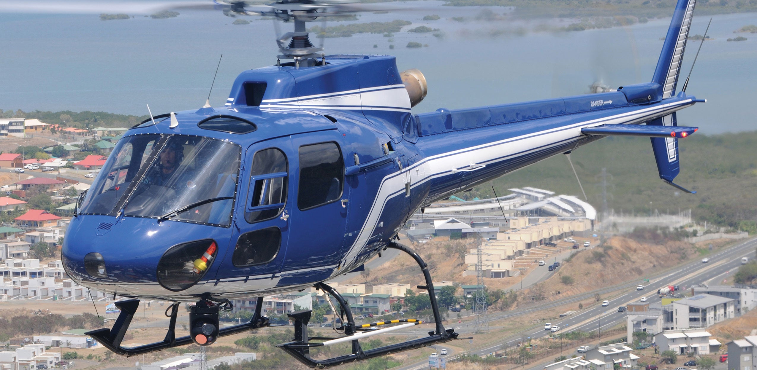
The WESCAM MX-10 is prevalent throughout the ALE market space. Further, L3Harris continues to see increased demand for system variants on domestic and international front line military platforms in air, maritime and land domains.
L3Harris leverages and adapts core technology to multi-domain environments such as inverted variants for ground and maritime applications, which continue to meet size, weight and power (SWaP) requirements.
Building on the original WESCAM MX-10 base design, the WESCAM MX-10MS (MS = Maritime System) is specifically optimized to withstand the harsh sea-going environmental conditions and excel during prolonged deployments providing unmatched situational awareness of all modern-day threats including coastal security, anti-piracy, navigational hazards or environmental monitoring applications.
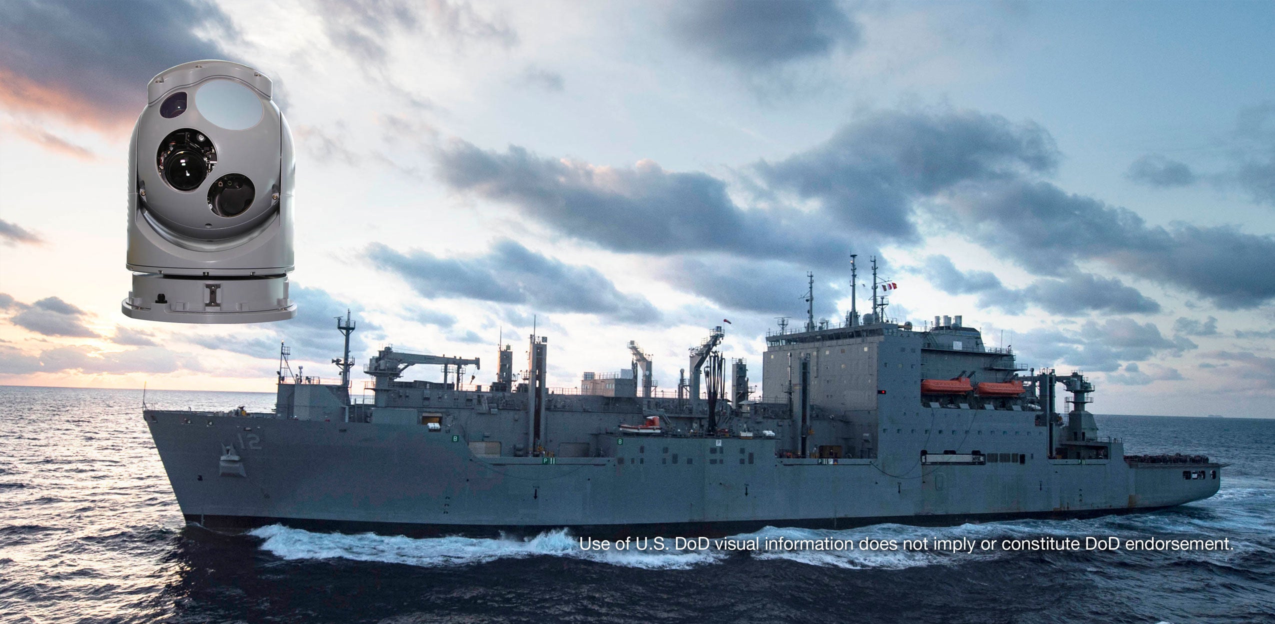
The WESCAM MX-10MS sensor suite on order from the U.S. Naval Surface Warfare Center, Crane Division (NSWC) for deployment onboard the fleet of Military Sealift Command ships will provide real-time situational awareness, reconnaissance and surveillance operations as well as coastal observation and navigational hazard support.
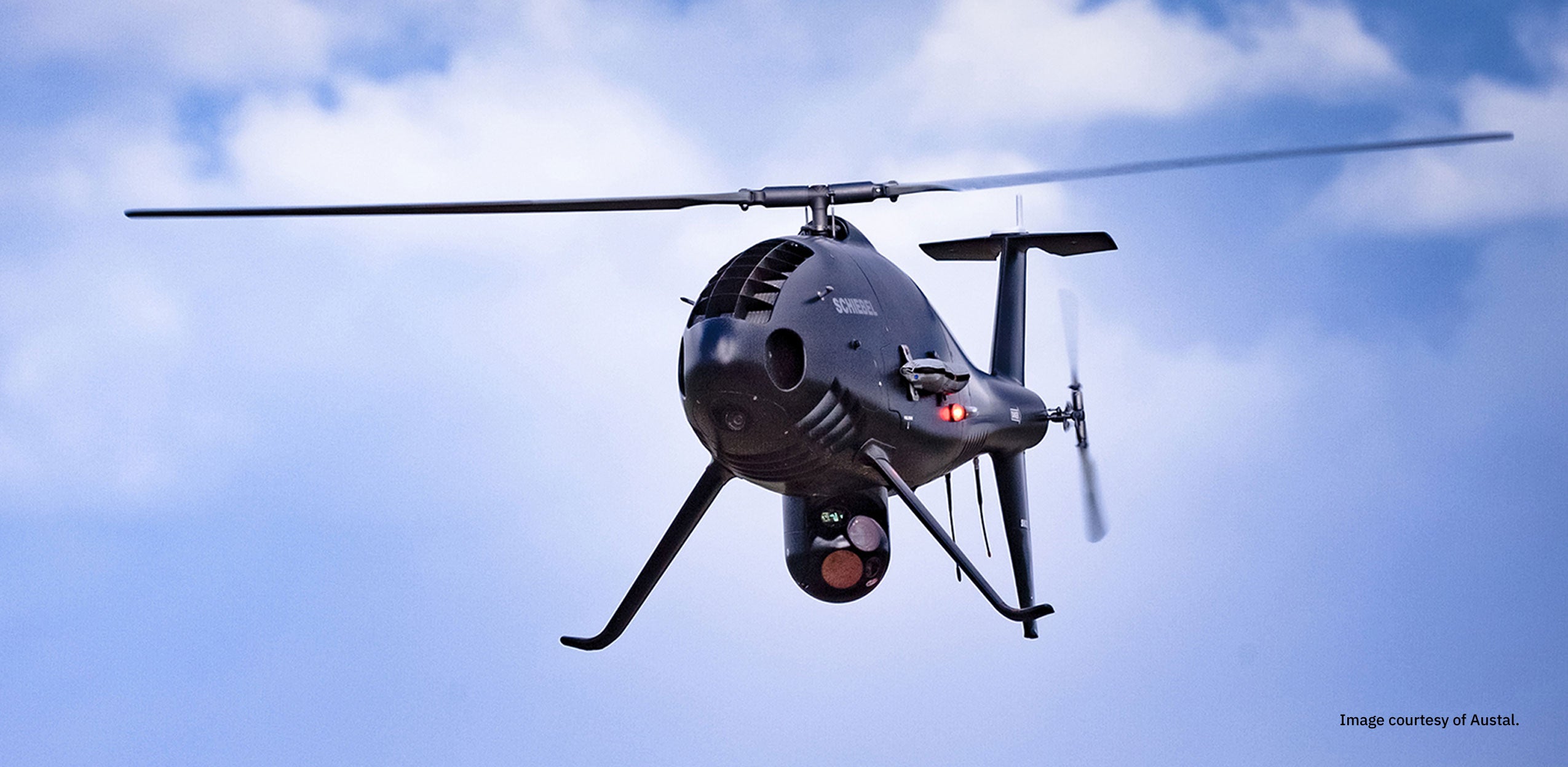
The CAMCOPTER® S-100 Unmanned Air System (UAS) is equipped with an L3Harris WESCAM MX-10, commended by operators in the field for its ability to carry out regular patrolling flights, on-demand incident monitoring missions and specific inspection operations.
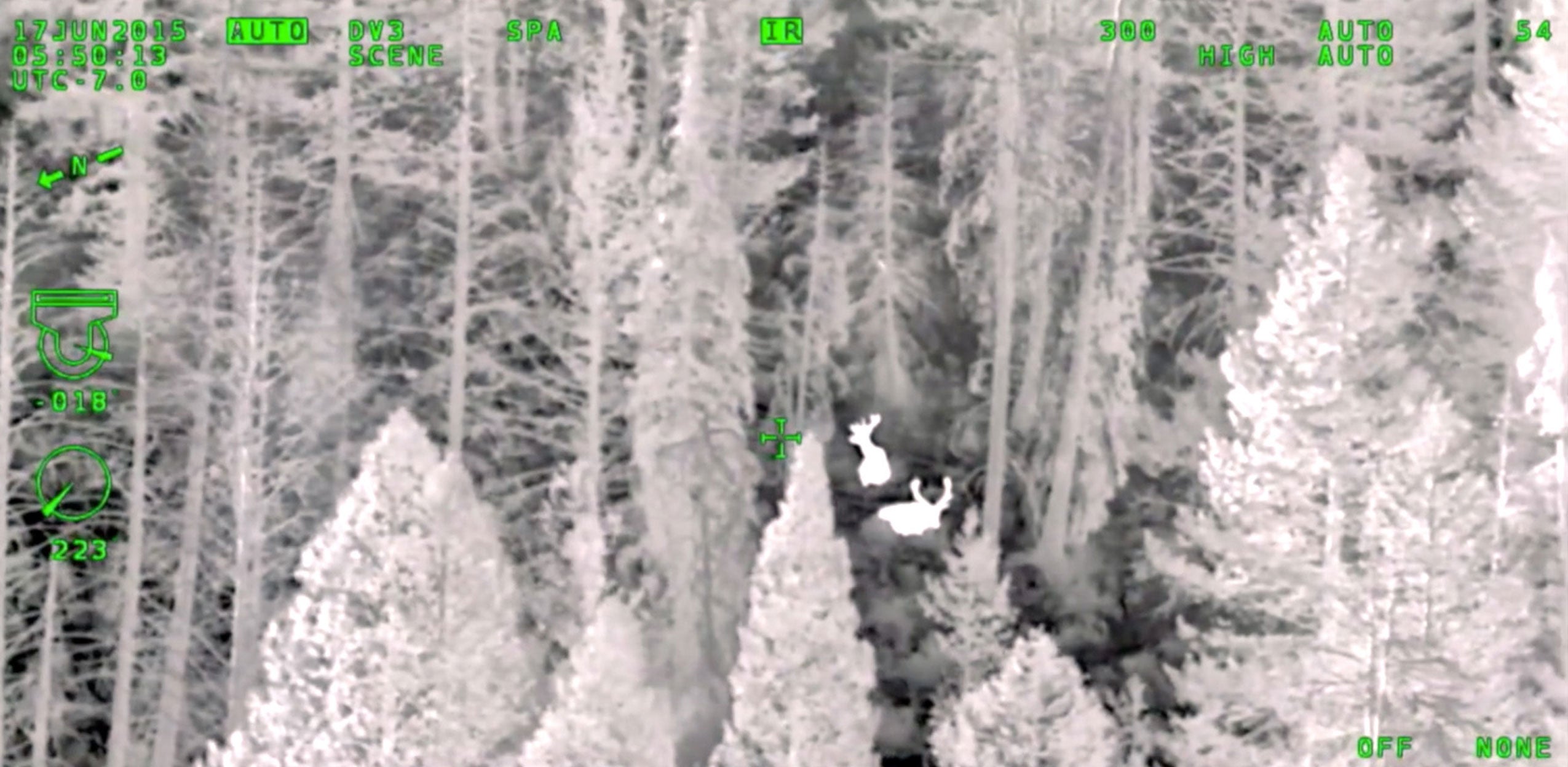
Idaho-based Owyhee Air Research (OAR) is at the forefront of using L3Harris aerial infrared technology in a wildlife and natural resource survey capacity. The WESCAM MX-10 enables OAR to perform its missions with less impact on the wildlife they are studying, thanks to the long-distance zoom.