Sorry, you need to enable JavaScript to visit this website.
Skip to main content

L3Harris Defends Against Global Extreme Weather Threats


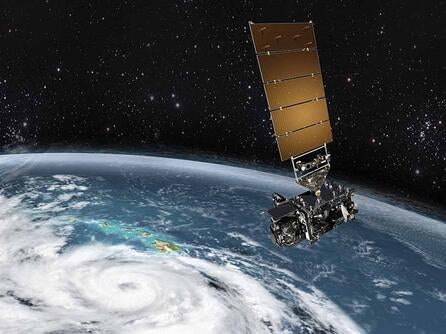
Catastrophic weather events are becoming more frequent, destructive and widespread than ever before

In 2023, the U.S. experienced 25 separate weather and climate disasters – totaling $81 billion in losses. And according to Adam Smith, a climatologist at the U.S. National Oceanic and Atmospheric Administration’s (NOAA) National Centers for Environmental Information (NCEI), the average annual cost of high-impact weather and climate events over the last five-years was $119.1 billion, nearly three times greater than historical averages.

Beyond the economic losses, the impacts to human lives are catastrophic. According to the U.S. Census Bureau Household Survey Data, in 2022, more than 3.2 million people in the U.S. were displaced by hurricanes, floods, fires and tornadoes.

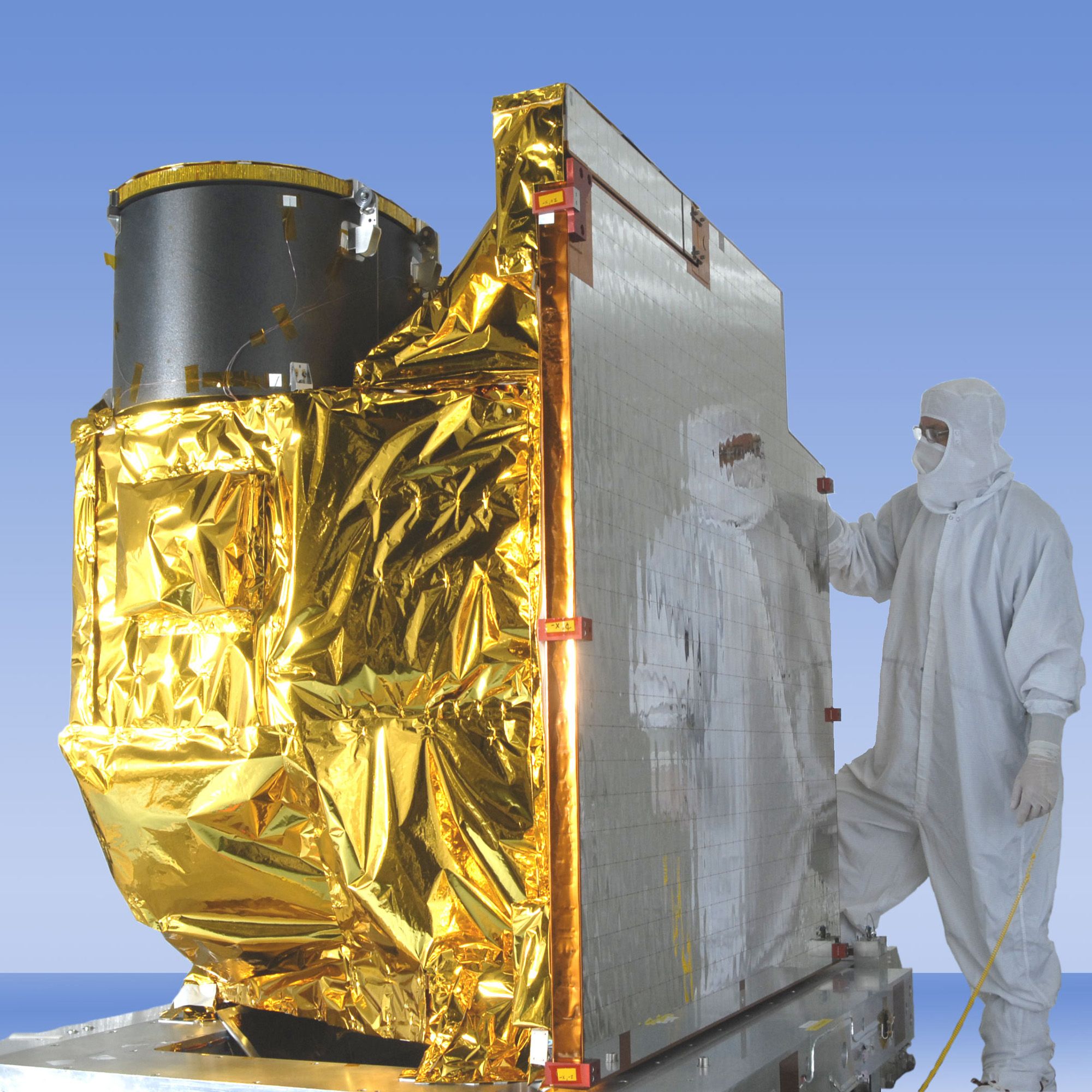
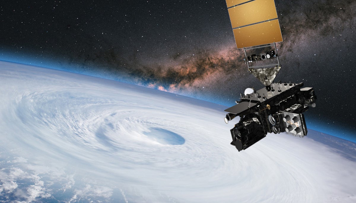
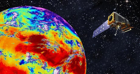
As weather threats intensify, advancing our ability to understand and better predict severe weather events is critical to protecting lives and property. That’s why government officials and scientists across the globe are investing in next-generation weather solutions to help defend against escalating environmental threats, including technology developed by L3Harris.

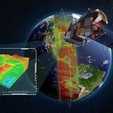
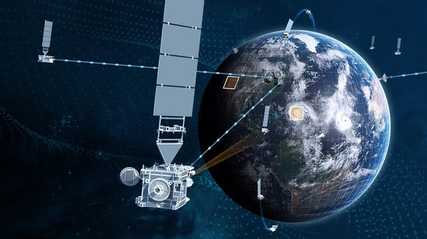
During 2023 alone, L3Harris was awarded more than $1 billion in weather-related contracts from domestic and international customers to deliver next-generation capabilities that counteract the threat of severe weather. This includes advanced imaging technology and multi-mission, real-time, high-throughput ground solution for the U.S., as well as next-generation imaging and sounding technology for Japan.

GOES-T Hero Image

Image: © L3Harris Technologies, Inc. 

But why are imagers and sounders in space important?

And how do they work together with ground systems to help us make important decisions, like seeking shelter when a tornado is about to touch down or staying out of the path of a flash flood, as well as convenient decisions, like knowing when to bring an umbrella, apply sunscreen or prepare for a storm.

Weather Satellite Imagers & Sounders: Preparing for Environmental Disasters Begins in Space

The race to stay ahead of dynamic weather patterns begins with highly detailed, accurate space-based observations of Earth. It’s the only way to rapidly monitor and revisit the entire globe and collect the comprehensive data necessary for weather prediction.

As hurricanes, wildfires, tornadoes and other environmental hazards form, meteorologists rely on instruments known as imagers, onboard weather satellites in different orbits around the Earth, as their “eyes in the sky.” These instruments constantly monitor the Earth in real-time for severe weather events to increase warning times and save lives.

Without space-based imagers, forecasters would be partially blind to severe weather conditions and environmental hazards – especially in areas where other measurements are sparse, like over oceans, where dangerous hurricanes grow and move toward populated coastal areas. Space-based assets provide concurrent global, continental and regional measurements as opposed to other ground-based methods.

Meteorologists also rely heavily on instruments known as infrared (IR) sounders to provide information about atmospheric moisture, temperature and pressure – all critical to forecasting severe weather and studying the climate. Imagers tell you what’s happening, while sounders tell you what’s about to happen. These complementary capabilities are vital to monitoring and accurately forecasting both near- and long-term weather events.

This critical imaging and sounding technology is where L3Harris excels.

California Wild Fire

For more than 60 years, we’ve been at the forefront of advancing weather satellite capabilities to improve forecast accuracy, measure climate change and increase life-saving warning times.

In fact, we provide world-leading imagers and sounders, from our proven capabilities on-orbit today – the Advanced Baseline Imager (ABI) and Cross-track Infrared Sounder (CrIS) – to our work on innovative solutions for the next generation of domestic and international weather architectures.

Proven On-Orbit Technology Designed to Evolve

Our ABI is the primary instrument onboard NOAA’s Geostationary Operational Environmental Satellite-R (GOES-R) series spacecraft – responsible for imaging the Western Hemisphere’s weather, oceans and environment. As the most advanced geostationary imager in the world, it can track a single storm, while simultaneously collecting continent-wide imagery, all from over 22,000 miles away from the surface of the Earth. We’ve also provided similar technology for the Japanese Meteorological Agency’s (JMA) Himawari-8 and -9 geostationary weather satellites and the Korea Aerospace Research Institute's (KARI) second geostationary satellite, GEO-KOMPSAT-2A.

Advanced Baseline Imager Solutions

Image: © L3Harris Technologies, Inc. 

CrIS is a key sensor on NOAA's Joint Polar Satellite System (JPSS) spacecraft, flying approximately 500 miles from the surface of the Earth in low-Earth Orbit (LEO). It collects critical global atmospheric data that serves as the backbone of both short- and long-term forecasts, which are essential for severe weather prediction and preparation.

And we’re continuing to advance these capabilities to stay ahead of current and future weather threats by providing the next-generation imager for NOAA’s Geostationary Extended Observations (GeoXO) mission as well as a next-generation imager and sounder for JMA’s Himawari-10 mission.

The GeoXO program, the follow-on to NOAA’s GOES-R Series program, will bring new capabilities to address emerging environmental issues and challenges that threaten the security and well-being of every American – by advancing Earth observations from geostationary orbit (GEO). As the primary instrument for NOAA’s GeoXO mission, our GeoXO imager (GXI) technology will be used for a wide range of applications related to severe storms, hurricanes, fire, aviation, natural hazards, the atmosphere and ocean.

In parallel, Japan’s next-generation Himawari-10 geostationary weather satellite, scheduled to launch in 2029, will use similar L3Harris imaging technology as NOAA’s GeoXO satellite system. But it’ll also harness next-generation sounding technology from L3Harris to improve typhoon track and heavy rain predictions. In the face of intensifying and wide-ranging weather threats, this use of common technology building blocks and international collaboration is more important than ever for saving lives and protecting property globally.

Our technology is designed to evolve – to continue transforming forecasting capabilities for decades to come. After all, reducing the time and cost it takes to deploy new instruments is critical to staying ahead of extreme weather.

The Future of Forecasting: One Mission, Multiple Orbits

L3Harris CrIS instrument observes infrared channels, providing comprehensive temperature and moisture information to improve weather models.

Image: © L3Harris Technologies, Inc.

Minimizing the impact of disasters like forest fires, flash floods, hurricanes, tornadoes and blizzards requires measurements from geostationary orbits and low-Earth orbits. While geostationary orbits provide persistent coverage for now-casting, low-Earth orbits provide the global coverage needed for forecasting and climate monitoring.

NOAA’s Near Earth Orbit Network (NEON) program will develop the next generation of LEO environmental satellites and improve global data refresh times by leveraging commercial industry investments to launch constellations of small to medium-sized satellites.

In alignment with this architecture of the future, we’re advancing our portfolio of small satellite (smallsat) solutions. This includes instrumentation for LEO IR sounding that builds on our CrIS heritage, as well as end-to-end mission solutions that support the entire mission value chain – from data collection to product distribution. We’re also optimizing our ability to deliver high-performance capabilities at volume by growing our production capabilities. This scalability is essential to supporting the global weather mission.

“Our ongoing investment in advanced, mature solutions which address customers’ evolving mission needs is a key component of L3Harris’ trusted disruptor strategy,” said Rob Mitrevski, Vice President and General Manager, Spectral Solutions, L3Harris. “In addition to technology development, we continue to focus investments toward business scale, with particular emphasis on process automation, production throughput, and employee skills development/transfer, which all combines to optimize performance, cost and schedule confidence for our customers.”

Bringing Life-Saving Data Down to Earth: The Importance of Ground Systems

L3Harris brings life-saving data down to Earth with high-performance ground systems and antennas.

If weather satellites are meteorologists’ “eyes in the sky,” then ground systems are their “boots-on-the ground” – enabling forecasters across the country to issue severe weather watches and warnings to people at risk.

This complex network of technologies, including antennas and high-performance computing, works together to bring satellite data down to Earth, process it and then reliably distribute the resulting data products to thousands of direct users worldwide, such as forecasters, research scientists and the public. This is done in near real-time, 24/7, to ensure that those in harm’s way have enough advanced notice to evacuate or find shelter.

As a prime contractor to NOAA, L3Harris designed, developed and deployed the core functional elements of the high-throughput, rapid-processing NOAA GOES-R ground and antenna systems and was recently awarded a contract to extend the system’s functionality. L3Harris is also implementing high-performance computing, machine learning, artificial intelligence and advanced antenna technologies to ensure the U.S. has scalable, secure and reliable ground systems that deliver life-saving weather information faster than ever before.

We’re also currently integrating the command-and-control capability for NOAA’s Space Weather Follow On (SWFO) mission into the highly scalable, multi-mission GOES-R ground architecture to monitor and forecast space weather events with the potential to adversely impact national security and economic prosperity.

This integration ensures that NOAA can cost effectively manage its growing satellite capabilities and constellations of the future.

Weathering the Storm: Innovation is the Key to Addressing Extreme Weather Head-On

Satellite hovers in space over earth and the eye of a hurricane

Image: © L3Harris Technologies, Inc.

Around the world, 2023 was a year defined by weather extremes. Tornadoes in the U.S. Midwest, record heat and fires in Greece, torrential downpours and mudslides in Japan, and a tropical storm reaching California are just a few of many examples.

Unfortunately, the pace and severity of weather events show no signs of slowing. In fact, scientists expect the effects of El Niño to continue into 2024, bringing higher risks of flooding, droughts and other environmental crises.

That’s why L3Harris is moving with urgency to deliver next-generation weather solutions that advance upon our proven ABI, CrIS and GOES-R ground heritage to improve short- and long-range forecast accuracy and increase life-saving warning times globally. These innovative solutions include a next-generation GeoXO imager (GXI) and modernized GOES-R ground system for the U.S. and next-generation imaging and sounding technology for Japan – all awarded as part of the more than $1 billion in weather-related contracts L3Harris received in 2023.

Our weather instruments and ground systems are paving the way toward a safer, more weather-ready world. By providing highly accurate and more detailed information faster than ever, these innovative technologies improve forecasting accuracy and warning lead times, so people have more time to prepare for and remain protected against extreme weather.

Related Articles

NOAA's GOES-T Satellite

Press release | 05. 31. 2023

L3Harris Receives Contract to Support NOAA’s GOES-R Satellites

NOAA awarded L3Harris Technologies the Geostationary Ground Sustainment Services contract, valued at up to $275 million, to provide services that extend the functions of the Geostationary Operational Environmental Satellite-R (GOES-R) ground system.

NOAA's GOES-T Satellite

Press release | 05. 31. 2023

L3Harris Receives Contract to Support NOAA’s GOES-R Satellites

Satellite hovers in space over earth and the eye of a hurricane

Press release | 03. 14. 2023

L3Harris to Design and Build NOAA's Next-Generation Geostationary Weather Imager

satellite in space

Press release | 04. 13. 2023

L3Harris to Build Geostationary Weather Satellite Sensors for Japan

Hurricane Ian: Predicting Environmental Disasters Begins in Space

Editorial | 12. 21. 2022

Predicting Environmental Disasters Begins in Space

L3Harris CrIS instrument observes infrared channels, providing comprehensive temperature and moisture information to improve weather models.

Editorial | 11. 14. 2022

Committed to Creating a Weather-Ready Nation

Contact Our Weather Team

Address