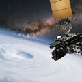
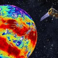
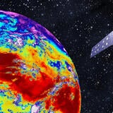
Sorry, you need to enable JavaScript to visit this website.
Skip to main content

GOES-R Series Ground Segment and Antenna Segment

ENABLING GOES-R SERIES ON THE GROUND

Managing a growing constellation of satellites and sensors, rapidly processing even larger volumes of data and quickly delivering information and products to users worldwide requires a scalable ground system. L3Harris built NOAA’s GOES-R Ground System to support the entire GOES-R constellation and future Space Weather Follow-On (SWFO) satellites. Drawing on its experience building this sophisticated ground system, L3Harris’ next generation ground system architecture will empower NOAA to focus on the mission rather than hardware and facilities.

L3Harris’ enterprise cloud-based services, high-performance computing, machine learning and artificial intelligence technologies ensure NOAA can cost-effectively keep pace with future data rate and volume demand. This highly scalable ground system architecture is expandable to support additional satellites and missions while maintaining high-throughput, low-latency data processing and high system reliability all with a reduced footprint.

16 infrared bands from GOES-16 ABI

ABI on GOES-16 captures imagery in 16 visible and infrared bands (NOAA/NASA)

ENABLING GOES-R IN SPACE

L3Harris’ Advanced Baseline Imager (ABI) is the primary instrument for the GOES-R Series, providing imaging of Earth’s weather, climate, oceans and the environment. Its advanced capabilities reflect more than 40 years of experience producing geostationary imaging radiometers.

ABIs are in orbit on GOES-East and GOES-West. ABIs will also provide advanced capabilities on GOES-T and GOES-U. In addition to supporting NOAA, ABI-class imagers are used onboard the Japanese Meteorological Agency (JMA)’s Himawari-8 and -9 satellites. The Geostationary Korea Multi-Purpose Satellite – 2A (GEO-KOMPSAt-2S) also carries an L3Harris ABI imager.

ADVANCEMENTS IN ABI

Advancing ABI’s capabilities can affordably be achieved with low-risk, high-reward improvements to its flight-proven technology. ABI technology has enabled meteorologists to increase the accuracy of their products, both in forecasting and nowcasting.

  • Views the Earth with 16 spectral bands providing three times more spectral information, four times the spatial resolution and five times faster coverage than the previous system.
  • Provides visible and infrared images of the entire hemisphere as fast as five minutes at resolutions starting at half a kilometer.
  • Supports coverage of severe weather events in 30 seconds with simultaneous full-hemisphere imagery and data.
  • Detects water vapor at three levels of the atmosphere compared with a single level previously.

GOES-R News Articles

Hurricane Ian: Predicting Environmental Disasters Begins in Space

Editorial | 12. 21. 2022

Predicting Environmental Disasters Begins in Space

Severe and complex weather events, like Hurricane Ian, are become deadlier and costlier each year. But we’re turning to space to help create a safer, more weather-ready nation.

Hurricane Ian: Predicting Environmental Disasters Begins in Space

Editorial | 12. 21. 2022

Predicting Environmental Disasters Begins in Space

L3Harris’ Advanced Baseline Imager onboard NOAA’s GOES-East satellite captured this full-disk image of a dust storm over the Kansas and Nebraska Plains.

Press release | 12. 20. 2021

L3Harris Completes Delivery of Imagers for NOAA’s Advanced Environmental Satellites

L3Harris GOES-R satellite above hurricane

Editorial | 05. 18. 2021

Active, Intense Hurricane Seasons Prove Need for Innovation in Space

GEO-XO

Press release | 04. 05. 2021

L3Harris Technologies Selected for Future US Weather Satellite Imager Design Phase Study

L3Harris NOAA SWFO Award

Editorial | 02. 19. 2021

L3Harris Selected to Develop the Ground System Command and Control for NOAA’s Space Weather Follow On Observatory

Contact the Weather Team

Address

Related Domains & Industries

Solutions that solve our customers' toughest challenges.
view all capabilities