Service Information
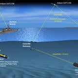
The Royal Australian Navy's (RAN's) Hydrographic Service is responsible for surveying and mapping (known as charting) more than one eighth of the world’s surface, from Cocos Island in the Indian Ocean, east to the Solomon Islands, and from the Equator to the Antarctic. The RAN has six ships and one aircraft engaged in this paramount and vital task. The nautical charts developed from data gathered are essential for safe navigation at sea and to further protect Australia’s ocean environment.
L3Harris works with the Australian Hydrographic Systems Program Office to sustain the RAN Hydrographic Sensor Suite Mission Systems as well as peripheral systems associated with training, portability, tactical operation and support.
We completed the RAN Survey Motor Launch (SML) Hydrographic Mission System Acquisition project (SEA 1401 Phase 3) in 2010 and have since continued supporting the systems as a subcontractor to BAE Systems. In 2013 we upgraded the RAN Antarctic Survey Vessel Wyatt Earp’s Tactical Hydrographic Survey System. The Navy’s Deployable Geospatial Support team has successfully completed surveys using the upgraded system on deployments in Antarctica.
We have a dedicated support team of field technicians based in Cairns, Queensland, who specifically work on the Hydrographic Mission Systems. All engineering and program management is done from Fremantle, Western Australia.