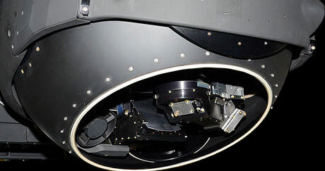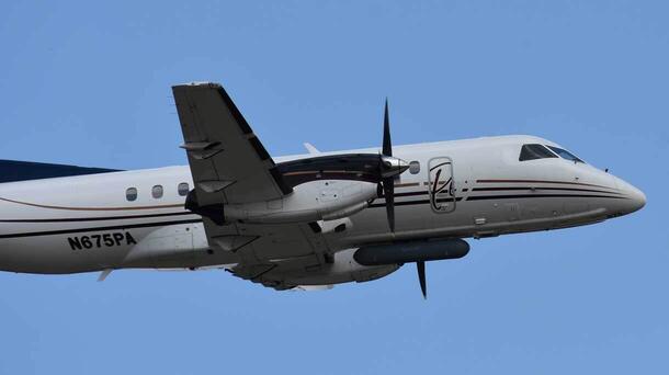
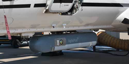
L3Harris Technologies is enhancing passive sensing technology for global customers to include situational awareness and mission intelligence gathering capabilities through real-world demonstrations in dynamic operational environments.
In a recent air-to-air flight test, L3Harris engineers validated new sensor accuracy, image quality and system processing performance against live airborne targets, which provided valuable insights to inform new development for mission-relevant use cases.
Staying on Course: Proving Precision in Flight
One of the central goals of the test was to verify the performance of the Inertial Navigation System (INS) and ensure the sensor remained accurately pointed throughout the mission. Throughout the mission, INS readings closely matched the aircraft’s true flight path, demonstrating stable and dependable performance. Early analysis shows that the system is on track to meet its final pointing-accuracy goals once planned refinements are implemented, reinforcing confidence in the system’s technical maturity.
“Every milestone like this strengthens confidence that the system will deliver reliable performance for our customers,” said Ryan McRae, Principal, Program Management. “Demonstrations like this are essential to maturing passive sensing technologies and moving them closer to mission-ready performance. The results confirm we’re meeting key performance targets and highlight clear pathways to accelerate capability growth.”
Clear, Reliable Imagery in Real Time
The test also allowed engineers to evaluate how the system handled real-time imagery at different speeds. During the flight, the air-to-air system consistently produced clear, low-noise images at both 30 and 60 frames per second, even as lighting and flight conditions changed. The smooth performance at higher speeds, combined with the absence of any dropped frames, confirmed that the system’s architecture can support demanding, real-time image processing consistent with higher technology readiness levels.
Verifying Software Accuracy in Flight
Another key part of the evaluation involved assessing how the system’s software interpreted and matched incoming imagery with flight data. To verify performance, engineers compared the system’s results to reference information from aircraft broadcasting their positions. These early comparisons aligned with expectations, showing that the software is correctly analyzing and correlating the data. Validating this performance in flight establishes a strong foundation for continued algorithm refinement and future capability expansion.
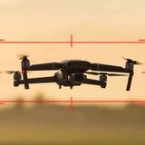
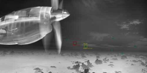
Detection and Tracking at Long Range
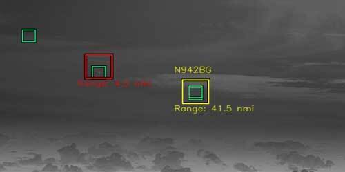
The flight also provided an opportunity to examine detection and tracking consistency at significant distances. During the mission, the air-to-air system achieved detection and tracking success at ranges greater than 40 nautical miles, offering engineers additional insight into performance across varying ranges and conditions. Demonstrating long-range performance in an operational environment highlights the system’s potential value across a wide range of mission scenarios. The data collected will support continued calibration and system analysis.
Next Steps in System Development
With the test complete, engineers are now working through the new dataset to identify and prioritize next-step improvements. Planned efforts include refining software and algorithm performance, improving sensor optical distortion correction, enhancing INS stability and alignment and developing new test cases informed directly by the flight data. Additional hardware and compute optimization will also be explored to support future capability growth as the system continues to advance its technology readiness level and demonstrate increasing operational relevance.
A follow-on air-to-air flight test is expected as part of the program’s ongoing maturation and continued progression of L3Harris’ passive sensing capabilities.