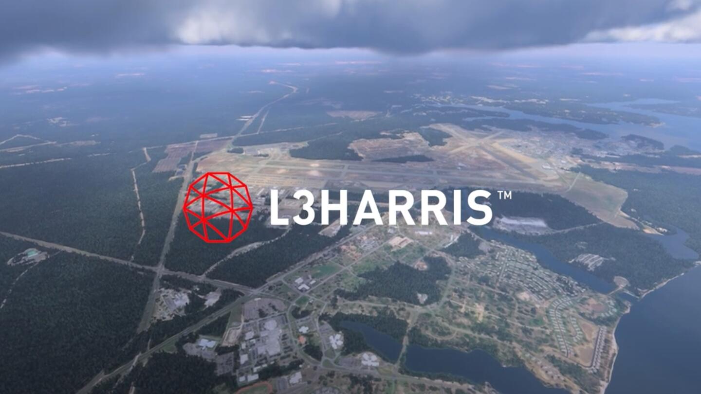
**Click Play to see Eglin AFB demonstration vi...

Accurate and realistic visual simulations are critical for safely training individuals in virtual environments. However, most geospatial foundational layers fail to meet cost, coverage, schedule, and quality constraints—but not ours.
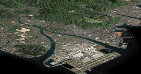
That's why governments, militaries, and commercial programs around the globe depend on L3Harris' TrueTerrain™ visual simulation products for advanced training. These bundled data layers include satellite and aerial imagery, elevation data, extracted vectors and features, 3D models, and multispectral material classified maps. They're precisely correlated and registered with the accuracy and resolution needed to train your organization for maximum results.
Our extensive selection of geospatial imagery datasets is the best in the industry. We have global partnerships with many satellite and aerial data suppliers, maintain a vast internal archive of products, and offer flexible licensing options to accommodate your budgetary requirements. From capturing the latest data over specific airfields to providing global coverage up to 50 centimeters, we ensure your visual simulations are realistic, flexible, and tailored to your unique goals.
Shorten your path to success: Work with our expert staff to explore geospatial data products ideal for virtual training, including imagery, elevation data, vector feature data, 3D models, LULC, AMDB and topographic maps. Whatever your geospatial needs, we'll ensure you get the right data products for your training and visual simulation programs.
| "Because of the scale of our productions and our ever-increasing needs for higher ground truth, we partner continuously with L3Harris to serve our needs." Javier Castellar, Co-Founder & Vice President of Programs – Aechelon Technology |
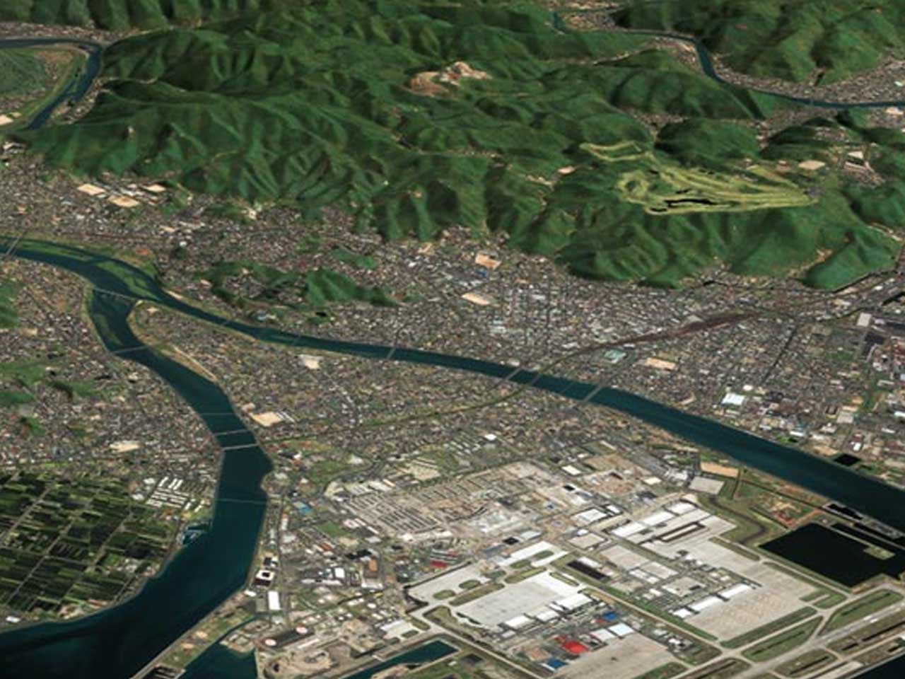
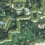
TrueTerrain imagery is high-quality, highly detailed visual data crucial in mapping, analysis, and decision-making across various applications.
L3Harris creates TrueTerrain imagery using advanced photogrammetric tools and techniques, which merge and mosaic multi-source, multi-resolution satellite and aerial imagery in resolutions ranging from 5 centimeters to 100 meters. Our TrueTerrain aerial imagery is rigorous and precise. It's orthorectified, co-registered, pan-sharpened, color-balanced, and seamlessly feather-blended into high-quality, visually pleasing orthomosaics custom-built for clients. We deliver TrueTerrain imagery with rich XML, FGDC-compliant metadata, cutline shapefiles with source-data attributes, and browse imagery.
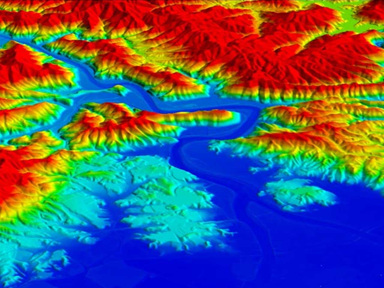
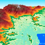
L3Harris can use various data sources (satellite, aerial, and LiDAR) to automatically process and produce high-quality, high-resolution, and high-accuracy Digital Elevation Models over large areas. Our automated processes offer a unique range of accuracy, completeness, and surface detail. We can deliver these datasets separately or use them to create orthorectified TrueTerrain Imagery products such as visual simulations.
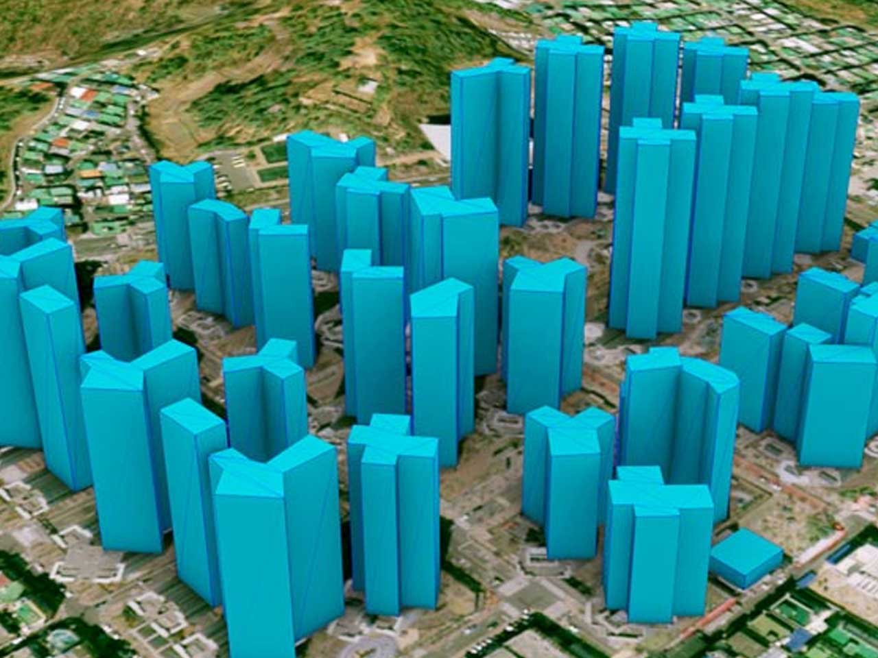
See your project clearly with the best building models in the industry derived from overlapping aerial and satellite imagery and LiDAR. Our building models provide unmatched detail and clarity and are available in various formats, including high-fidelity, photo-realistic, textured 3D models or as 3D polygon files. Need to model a large area? L3Harris can help. We've developed proprietary tools that use project and archival data to create 3D models with superior accuracy, realism, and precision. We deliver models in every format, from 3D shape files, DXF, and Geo VRML to VRML, OpenFlight, InReality™, and Maya ASCII.
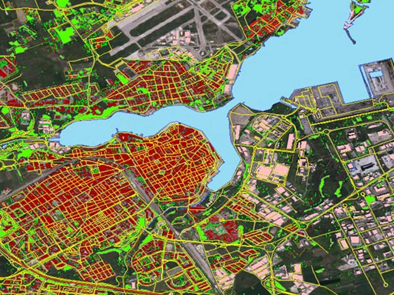
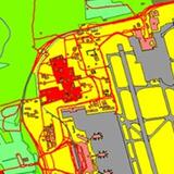
Collaborate with L3Harris to leverage the power of vector data. Choose from various digital vector data, including line, polygon, and point data sets, perfect for creating dynamic visual simulations. We extract this data from project-specific imagery, maps, or archived imagery to create layered, georeferenced products. Hyper-realistic, these layers include linear networks and boundaries, including roads, rail lines, runways, buildings, coastlines, rivers, and cultural boundaries. They also comply with requirements set forth by VMAP Levels 1 and 2 and ICAO and are easily customized, making them ideal for military and commercial use.
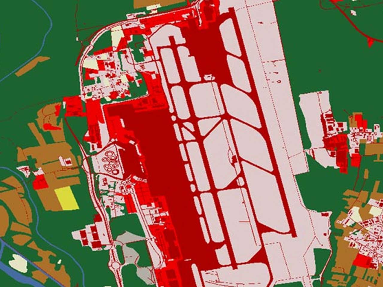
L3Harris' material classified maps play a vital role in realistic visual simulation, military applications, and accurate mapping by categorizing geographic areas based on the materials they comprise. We correlate and present these details in the same pixel resolution as our TrueTerrain imagery, including out-the-window views within the Simulation Image Generator.
We use material classification to accurately represent night vision and infrared simulations, which are crucial for military training and operations in lowlight or thermal conditions. Classification also contributes to the development of radar visual databases, allowing for realistic radar simulations. Through material classification, we can map high detail, geotypical textures with real-world accuracy, ensuring your visual simulations precisely represent a location’s terrain.

SATELLITE IMAGERY
Part of our global dataset, this superior base map provides seamless global coverage with up-to-date and nearly cloudless satellite imagery in resolutions ranging from 50 centimeters to 15 meters. Features include:
Optimized contrast to maximize information content
ELEVATION DATA
L3Harris is the leading source for all your elevation needs—from Digital Elevation Models to advanced datasets for visual simulations. We offer the best selection of multi-resolution elevation datasets from 50 centimeters to 90 meters from leading geospatial data providers around the globe.
“Throughout Aechelon’s twenty-one-year history, our company has maintained an unparalleled track record in program deliveries for the US Marine Corps, US Navy, US Air Force, US Army, Special Operations Command, US Government Foreign Military Sales Program and the US Coast Guard, thanks in part for relying on geospatial multi-spectral L3Harris data products.” - Javier Castellar, Co-Founder & Vice-President of Programs for Aechelon Technology

Press release | 07. 13. 2026
L3Harris Technologies has received a contract from the U.S. Space Force’s Space Development Agency (SDA) to produce 18 Accelerated Missile Defense Tranche 3 (AMDT3) satellites to support the Golden Dome for America’s space-based capabilities.