Sorry, you need to enable JavaScript to visit this website.
Skip to main content

Advance Tasking: Geospatial Data Solutions

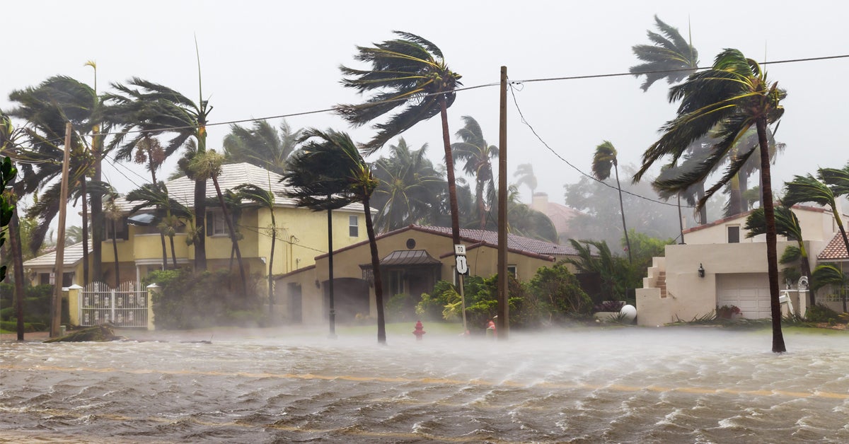
“You’d rather have something and not need it, than need something and not have it”

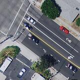
Commercial Satellites are flexible and reactive, but timing is critical.  High resolution satellites are not limited to predictable, regular, and set patterns the way the larger swath and lower detailed sensors such as Landsat and Sential are. They have capabilities to look where they are programmed and react to the needs given to them. The possibility of obtaining new imagery of a given location are high but in a given time frame can be difficult in some cases due to the satellite location in orbit. While there are vast archive data options, if a need is anticipated, then the best choice is to schedule imagery collections of the site in advance.

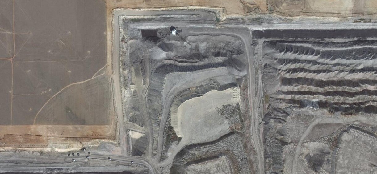
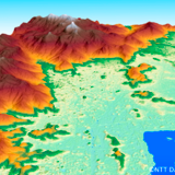
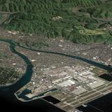
Advance tasking can help mitigate disasters, track critical mining resources, monitor construction site progress and airport operations.  Our one-stop shop for geospatial data solutions allows you to prepare for future events by extracting actionable data from a project site before it's urgently needed - saving time, eliminating errors, improving decision-making, and generating desirable outcomes. You can apply advance tasking to imagery and 3D data of the area's terrain and structures. Since documenting the terrain before and after an event requires stereo imagery source for the elevation data, advance tasking can ensure you are able to document both scenarios.  

“Outstanding communication and flexibility throughout the years has allowed us to make the necessary changes to our satellite schedule on the fly” - Kurtis Popkie, Westmoreland Mining

Time Sensitive Tasking

When it comes to environmental disasters like hurricanes, flash floods, tornadoes, blizzards and forest fires – every second counts.

Disaster Mitigation

  • Hurricane: Catalog a site’s infrastructure condition well before a hurricane makes landfall. 
  • Flooding: Monitor an area with abnormally high snowpack where the anticipated runoff may cause flooding.  
  • Wild Fires: Document structures in areas with high levels of fire danger and excess dry timber to mitigate losses linked to forest fires. 
  • Landslides: Log the state of the terrain in areas of seismic instability to prepare for possible landslides. 
  • Earthquakes: Research areas of known fault lines and active earthquake locations. 
sas-geospatial-mining

Construction/Mining/Agriculture/Airport Operations

  • Construction: Construction or solar array installation where the land and structural surface are rapidly changing can benefit from persistent monitoring to track progress.
  • Mining Monitoring: Few areas on earth change more rapidly than an active open pit mine.  Many of L3Harris’ mining customers are seeing added value and reduced costs with monitoring their locations remotely using regularly updated satellite imagery.  This is used as a method to track the progress of the mine, help with environmental recovery and future planning as well as detect signs of minerals in some cases. 
  • Agriculture: Ensure that agriculture applications can follow growing season patterns. 
  • Airport Operations: Airport operations use up-to-date new satellite imagery to ensure safe and efficient airport operations.

Leveraging global partnerships with satellite, aerial, and elevation data providers, L3Harris offers the market’s most extensive selection of high-quality geospatial data solutions.   Whether you need to map a large construction site, monitor the recovery progress of a one-time event, or plan your organization’s annual data capture, we can help you revolutionize your data and add measurable value to your project — right now.

Work with one of our experts today to get a detailed comparison of our wide variety of geospatial data solutions.  Your project is unique — and so are your needs.  Our team of experts will work tirelessly to provide the right geospatial data products for your project’s success. Your project is unique — and so are your needs.  Our team of experts will work tirelessly to provide the right geospatial data products for your project’s success.


Request A Quote

“Rebecca at L3Harris provides consistent, comprehensive, and customizable solutions for our project needs. The data is always good quality and turnaround time is always quick. Customer service though is the highlight. Rebecca is always incredibly helpful and informative, helping us get exactly what we need while staying on budget and on schedule, making the project a success every time.”  - Lane Feschuk, Senior GIS Analyst / IT Coordinator, Paragon Soil and Environmental Consulting Inc. 

Terms and Conditions

  • Event Placeholder Banner

    Data & Imagery Products Policies

Related News

Optical Technician lays on diving board suspended between NASA's Nancy Grace Roman Telescope's mirrors.

Editorial | 04. 17. 2024

L3Harris Team Aligns 10 Mirrors for NASA's Roman Telescope

In a feat of precision engineering, L3Harris demonstrated the telescope’s ability to capture crisp images from deep space.

Optical Technician lays on diving board suspended between NASA's Nancy Grace Roman Telescope's mirrors.

Editorial | 04. 17. 2024

L3Harris Team Aligns 10 Mirrors for NASA's Roman Telescope

Womens Global Gathering 2024 Luncheon

Editorial | 04. 10. 2024

L3Harris Hosts Women’s Global Gathering Panel on Shaping the Future Space Workforce

Cross-track Infrared Sounder (CrIS) and JPSS-4

Editorial | 04. 10. 2024

L3Harris Completes Critical Test of Advanced Sounder for NOAA’s Fourth JPSS Weather Satellite

Total Solar Eclipse

Editorial | 04. 05. 2024

Total Solar Eclipse: A Time to Marvel at the Skies and Reflect on Decades of Discovery

GOES-R Ground Celebration

Editorial | 02. 01. 2024

L3Harris, NOAA and NASA Celebrate 14 Years of Partnership on GOES-R Ground Segment

Related Domains & Industries

Solutions that solve our customers' toughest challenges.
view all capabilities