Capture the unique characteristics of any place on Earth with the best 3D models in the industry — including 3D city models derived from aerial and satellite imagery and LiDAR. L3Harris’ building models provide unmatched detail and clarity and are available in a variety of formats, including high-fidelity, photo-realistic, textured 3D city models and 3D polygon files.
VISUALIZE COMPLEX ENVIRONMENTS WITH 3D CITY MODELS
Need to model a large area? Whether it’s a piece of sprawling farmland or a bustling, densely packed city, L3Harris can help. We've developed proprietary tools that use project and archival data to create 3D city models with superior accuracy, realism, and precision. Our 3D city models enable virtual exploration, analysis, and simulation of cities — making them perfect for applications ranging from urban planning and real estate development to disaster management and smart-city initiatives.
We deliver detailed models from simple to complex in every format, including 3D shape files, DXF, Geo VRML, VRML, OpenFlight, InReality™, and Maya ASCII. Additional features include:
Geospecific textures derived from imagery can be applied to the buildings where available
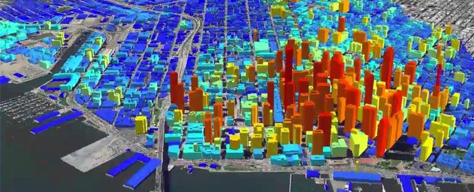
Photogrammetrically derived building heights produce accurate and realistic representations of structures
Multiple supported industry-standard formats are available, including OpenFLT, AutoCAD DXF, OBJ, and more
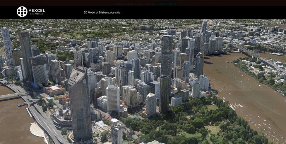
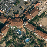
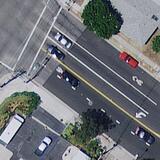
Leveraging Vexcel’s high-resolution aerial imagery and geospatial data, 3D Cities offer super-detailed and realistic views for major metro areas. Customers can fly through immersive and accurate 3D cityscapes at scale, every commercial building, road, and property is mapped from city centers to residential neighborhoods.
Vexcel 3D data comes packaged in the 3D Tiles OGC Community Standard created by Cesium, a flexible, open-source popular tile format that allows you to adapt, integrate, and interact with the data across almost any platform you work with. Vexcel 3D data is also optimized for high performance for streaming and consuming detailed and intricate data and lends itself to customized 3D visualizations.
Specifications
3D Type:
Textured Mesh
3D Format:
Cesium 3D Tiles 1.1
3D Delivery:
On-prem
Imagery Resolution:
7.5cm
Imagery RMSE x/y/z:
15cm
The use of 3D models has become a staple for multiple industries, especially when it comes to design, planning, and analysis. Across Government, Telecom, AEC, Utilities, Transportation, Entertainment, Technology, and Mapping industries, project managers are using 3D data to enhance their visualization. City engineers create digital twins for smart city planning, construction engineers perform viewshed analysis, video game designers enhance augmented reality applications, and telecom network designers map clean lines-of-sight. Improve your real world understanding with immersive, accurate 3D models across your workflows.
Vexcel is releasing 3D Cities in more than 60 cities, covering more than 62,000 km2 on four continents. And it plans to add more 3D cities and metro areas based on customer demand. Here’s the city list:
AUSTRALIA
Sydney Adelaide Brisbane Melbourne Perth Canberra Gold Coast
AUSTRIA
Vienna
CANADA
Vancouver Ottawa Toronto Calgary
GERMANY
Berlin
IRELAND
Dublin
JAPAN
Chiba Fujioka Fukaya Haneda Hiroshima Ichihara Kamakura Kamisu Kashiwa Kawasaki Kobe Kuki Kyoto Narita Odawara Osaka Ota City Shinjuku City Shiroishi Tokyo Toyonaka Yokohama
NETHERLANDS
Amsterdam
UNITED KINGDOM
London
UNITED STATES
Atlanta Austin Boston Brooklyn Chicago Dallas Denver Fort Worth Honolulu Houston Las Vegas Los Angeles New York City Miami Orlando Phoenix San Diego San Francisco San Jose Seattle Tampa Washington D.C.
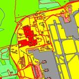
The possibilities for 3D mapping are limitless — ranging from wireless planning, city planning, infrastructure management, disaster management, and environmental monitoring to applications in public health and academic research. AW3D 3D city maps are defined by elite performance, cost-effectiveness, short delivery times, and unmatched flexibility. The quality of this 3D data will only improve as the number of available satellites increases and satellite-mounted sensors become more sophisticated.
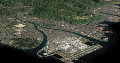
The AW3D Building 3D elevation dataset uses the latest satellite imagery to bring ground features such as buildings, vegetation, and overpasses to life. Both the 2D footprint and height information of each building are provided as vector data, which can be bundled with other layers to create sophisticated, intricately detailed 3D city maps.
This dataset is perfect for various simulation applications such as telecommunications, asset planning, and line-of-sight analysis.
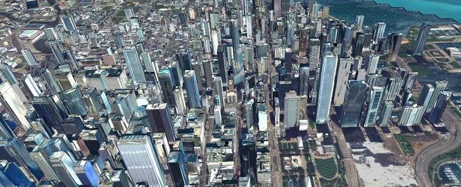
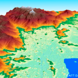
Do you need to render a congested urban area in fine, high-quality detail? AW3D Metro is a precise, large-scale 3D city model with national and statewide coverage. These 3D city models consist of accurate digital vector maps of buildings, vegetation, bridges, and other artificial structures as well as 3D raster data in resolutions ranging from 0.5 to 1 meter. Whether you're simulating 5G networks, analyzing natural disasters, or devising tomorrow's smart cities, this dataset from AW3D will help you make better strategic decisions faster.
US Space Force Selects L3Harris to Provide Advanced Tracking Satellites for America’s Missile Defense
L3Harris Technologies has received a contract from the U.S. Space Force’s Space Development Agency (SDA) to produce 18 Accelerated Missile Defense Tranche 3 (AMDT3) satellites to support the Golden Dome for America’s space-based capabilities.
Press release | 07. 13. 2026
US Space Force Selects L3Harris to Provide Advanced Tracking Satellites for America’s Missile Defense
Editorial | 06. 29. 2026
NASA Awards L3Harris Contract for Search-for-Life Mission
Editorial | 04. 15. 2026
Advancing America’s Space Defense: L3Harris Completes Critical Milestone on Way to Delivering GBOSS Capability to the Warfighter
Editorial | 04. 14. 2026
Reimagining Earth Measurement for the AI Era: L3Harris and Xoople Develop a New Spaceborne Capability
Press release | 04. 07. 2026
US Space Force Selects L3Harris to Strengthen America’s Defense with Advanced Space Surveillance