L3Harris Technologies’ geospatial data products team has played an integral part in developing global product lines in collaboration with our customers and partners. Our comprehensive geospatial solutions have been serving government and commercial industries for decades, supporting crucial mission and business needs.
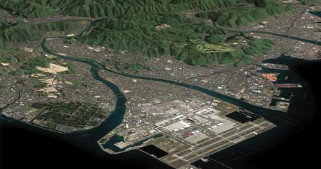
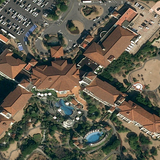
Satellite Imagery
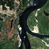
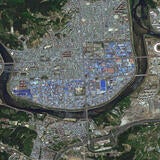
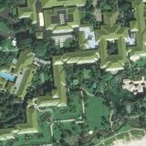
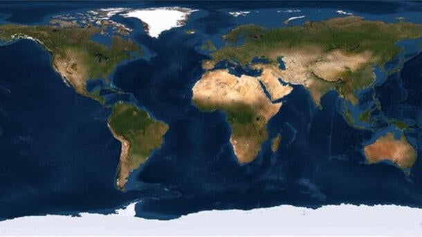
The most widely utilized global datasets within the L3Harris portfolio are satellite image global mosaics. Our complete product line provides superior global coverage with up-to-date and virtually cloud-free satellite imagery in resolutions ranging from 30 centimeters to 15 meters.
Key features include:
- 100% true-color, pan-sharpened imagery
- Seamless, color-balanced global mosaics also available by country or region
- Minimal cloud cover and optimal collection angles
- Optimized contrast for maximum information content
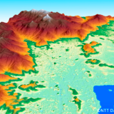
Elevation Data
Another important part of the L3Harris offering is the global elevation dataset. L3Harris is the leading source for both Digital Surface Models (DSM) and Digital Terrain Models (DTM) elevation data. We offer multi-resolution elevation datasets from 30 centimeters to 90 meters from leading geospatial data providers worldwide. While the highest-resolution data sets are not yet complete for the globe, we offer off-the-shelf global elevation datasets at 5-, 10-, 30- and 90-meter resolutions.
Key features include:
- Global coverage (pole-to-pole)
- Landmass of the Earth (~ 148.5 million square kilometers)
- Advanced processing of all multi-source data
- Available in DTED and GEOTIFF formats
L3Harris Delivers Proven Solutions
Look no further than the L3Harris geospatial data products team for the best selection of up-to-date datasets all in one place, for both global and regional needs. Our experienced geospatial analysts offer complete end-to-end service. For decades, this team has delivered the right product at the right time for the right value. Our global partnerships with many data suppliers, vast archive, and flexible licensing allow us to meet or exceed customer cost coverage, schedule and quality requirements. To learn more, contact us today at GeospatialData@L3Harris.com.