AN EDUCATIONAL SERIES – FROM THE GEOSPATIAL DATA PRODUCTS TEAM
This access to commercial satellite imagery has become increasingly democratized. Students, startups, researchers, and curious minds are leveraging satellite data for various applications. But what if we told you there are some common misconceptions about this apparent treasure trove of images?
This blog post addresses these misconceptions — investigating and debunking the myths about satellite images, uncovering their complex reality, and how elite providers obtain them.
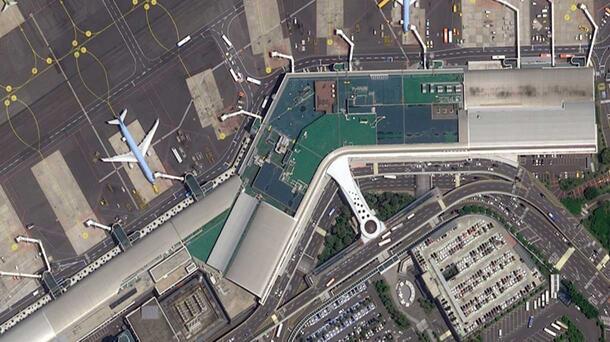
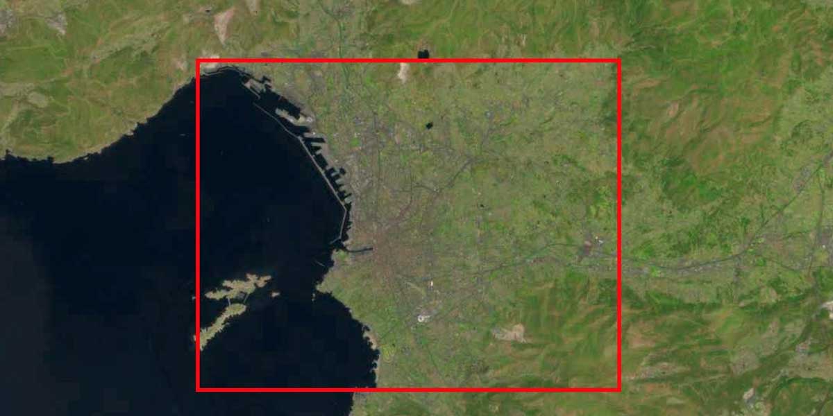
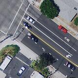
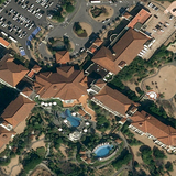
30cm NEO imagery from Pleiades © CNES 2021, Distribution Air...
Gathering Imagery is Free, Quick, or Easy
Perhaps the most widely held misconception about satellite images is that obtaining them is as effortless as a Google search. Many users expect these images to be readily available at little to no cost. After all, Google Earth provides satellite views for free, right?
The truth is far more complex. Commercial satellite imagery is a product of sophisticated technology and infrastructure. Optical imagery sensors undergo years of planning, approvals, intricate design, delicate construction, and complex calibration processes. These satellites orbit hundreds of miles above the Earth's surface at astonishing speeds, and capturing images with stunning clarity is no simple feat. While it might appear as a mere photograph, the output from these sensors is the byproduct of meticulous efforts of collection and processing, making it far from a quick or cost-free resource.
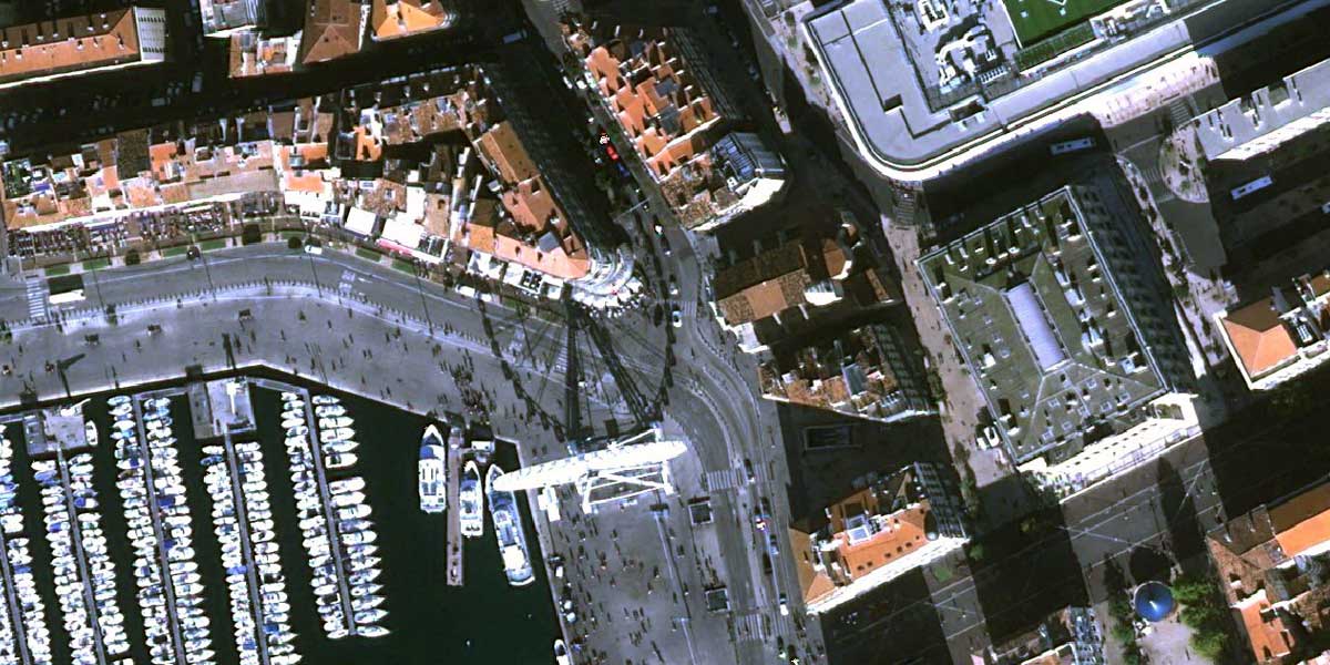
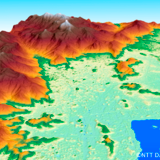
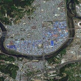
15m Landsat 8 Imagery from USGS EarthExplorer...
Historical Data Predates Satellites
Some might assume satellite imagery has been available for decades, capturing our world's transformations. It's a fair presumption in this era of instant information. However, the truth is quite different.
High resolution commercial satellite imagery, as we know it today, originated in the late 1990s. The first submeter sensor, IKONOS, was launched in 1999, providing the world with its initial taste of high-resolution commercial satellite images. Before this era, satellite imagery was limited to coarser resolutions, which couldn't capture the intricate details we've grown accustomed to. Historical imagery before the satellite age typically comes from aerial archives, where photography from aircraft has preserved slices of time since the early 20th century.
Satellites Capture Images Nonstop Throughout the Orbit
Satellites are often depicted as tirelessly snapping images from orbit, keeping an unblinking eye on our planet. With recent technological advancements, mid-resolution satellites are now capable of collecting daily coverage, allowing more up-to-date and comprehensive data. But the reality remains less intense than the movies might indicate.
Commercial optical satellites follow specific patterns and schedules. The majority of these satellites operate in sun-synchronous, polar orbits. They circle the Earth, traversing from the North Pole to the South Pole approximately 14 times a day. However, they only capture data at particular times, typically around 10:30 a.m., when there is sufficient light. This timing is ideal for avoiding afternoon cloud cover that can disrupt data collection.
These satellites are task-oriented; they tilt their cameras to capture images of specific targets along their orbits. They don't capture images continuously throughout their journey, primarily due to limitations in onboard data storage and downlink capabilities. It's important to note that even though they capture hundreds of thousands of square kilometers per day, our Earth spans over half a billion square kilometers.
They’re Crime Stoppers
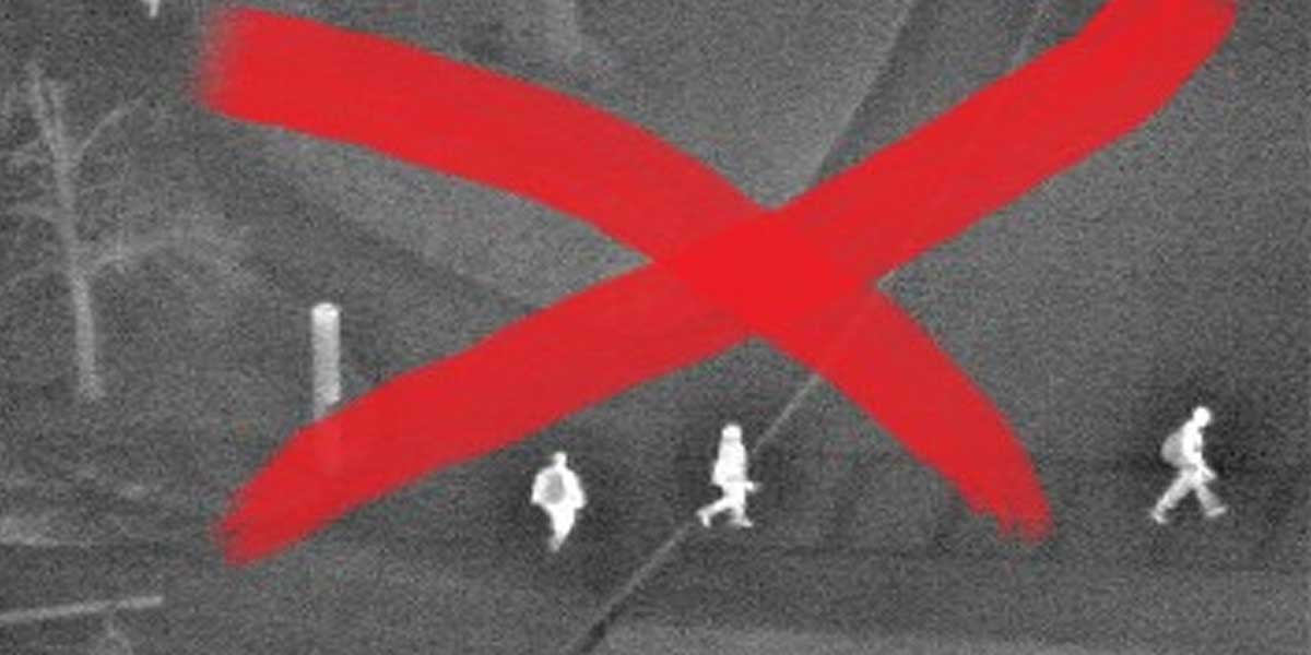
The portrayal of satellite imagery in movies and popular culture often leads to the belief that these images can pinpoint specific individuals or quickly identify cars parked suspiciously near a crime scene. While it's true that commercial sensors offer remarkable detail, it's vital to understand their limitations.
Commercial satellite imagery provides static images; the highest resolution is 30 centimeters per pixel. This level of detail allows for differentiating between types and colors of vehicles and discerning large crowds of people. However, it cannot distinguish an individual person unless they cast a distinctive shadow. It's true: Sensors can help anyone visualize complex environments with startling accuracy. They capture the most recent satellite imagery that forms the foundation of dozens of geospatial applications, from 3D maps to hyper-realistic training simulations. But they aren't designed to identify people or vehicles.
Live Satellite Imagery Exists
The concept of live satellite images, with satellites tracking individuals or vehicles in real-time, is a fascinating yet unrealistic notion. In the realm of Hollywood, such scenarios are commonplace. Think of satellites chasing a suspect running through a dark forest or tracking a fleeing vehicle during a high-speed chase. Unfortunately, this is a myth.
The most recent satellite imagery is not a live video feed, and there are no joystick-wielding operators on Earth directing satellites to follow dynamic events. Satellites cannot instantaneously track a criminal or swiftly respond to a developing situation. Collecting, storing, orbiting, downlinking, processing, and delivering data from space takes time. It also requires expertise; the average user lacks the knowledge and skills to process satellite data into a usable image. While it would be valuable for law enforcement and counter-terrorism efforts, the technology to provide live satellite images in this manner still needs to be discovered.
ChatGPT Images are Interchangeable with Satellite Images
In the era of Artificial Intelligence (AI), we've witnessed the growth of image-generation technologies like DALL-E 3. Some might assume that AI-generated images are interchangeable with authentic satellite images. It's a tempting idea, but reality begs to differ.
Behind every commercial satellite image are years of development and calibration. They offer unique geospatial data that AI-generated images cannot replicate. While AI has certainly lowered the cost of image generation and data analysis, satellite images processed and edited by experts are valuable resources users can trust when making critical decisions. Images generated by AI are just that — artificial.
***
There's no denying that commercial satellite imagery is a powerful tool that has become increasingly accessible. However, it's essential to dispel these misconceptions and approach satellite imagery with a clear understanding of its capabilities and limitations.
Satellite imagery is more than a mere image; it's a product of human ingenuity, dedication, and boundless technological growth, one that's continuously redefining our relationship with space.
L3Harris always strives to provide the best data sources and solutions for your project. However, it's crucial to recognize the distinctions and complexities involved in satellite imagery and how we obtain it. Commercial satellite imagery is not a panacea — but with proper understanding and direction, it can be precisely what you need to bring your project into focus.
Talk with our team today about how we can offer commercial satellite imagery for your projects. Please don’t hesitate to contact us at geospatialdata@l3harris.com.
Related Capabilities


Related News
Press release | 07. 13. 2026
US Space Force Selects L3Harris to Provide Advanced Tracking Satellites for America’s Missile Defense
L3Harris Technologies has received a contract from the U.S. Space Force’s Space Development Agency (SDA) to produce 18 Accelerated Missile Defense Tranche 3 (AMDT3) satellites to support the Golden Dome for America’s space-based capabilities.