For decades, understanding the physical world from space has required a trade-off between precision, scale and timeliness. As artificial intelligence becomes embedded in how governments and enterprises make decisions, those trade-offs are no longer acceptable. High-confidence, globally consistent measurement is increasingly foundational – not just to insight, but to action.
It is against this backdrop that L3Harris Technologies and Xoople have developed a next-generation spaceborne measurement system purpose-built for the AI era. The collaboration reflects a shared belief that the future of Earth intelligence depends on combining uncompromising measurement rigor with modern data infrastructure capable of operating at planetary scale.
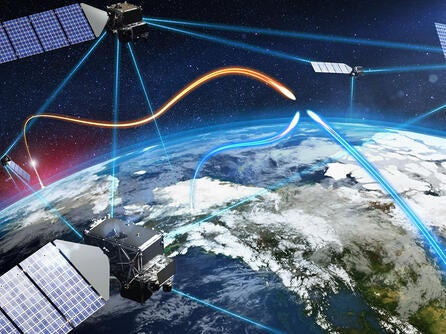
At the core of the effort is a satellite constellation designed to deliver data 100x over the gold standard as a persistent measurement layer for the physical world. This capability forms the foundation of what can be described as an Earth’s system of record, a trusted reference framework that enables AI systems to reason about real-world context with far greater accuracy and confidence than is possible today.
Reinventing Precision Earth Monitoring
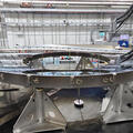
The collaboration draws heavily on L3Harris’ heritage in precision sensing and integrated space systems. The advanced imaging payloads developed at L3Harris' Rochester, New York, facilities bring a level of optical performance, geospatial accuracy and measurement stability that is essential for AI-ready Earth data infrastructure.
"L3Harris will supply the advanced imaging payloads and integrated systems engineering that form the core of this new Earth observation capability," said Carolyn Cossavella, General Manager, Exquisite Systems, L3Harris. "We're ensuring that the AI systems making tomorrow's critical decisions have access to Earth observation data of uncompromising quality and precision."
Global Reach, Real‑World Impact
L3Harris has contributed critical instrumentation and systems expertise to many of the world’s most advanced Earth observation and space science missions, including the WorldView series and flagship space observatories such as the Hubble and James Webb Space Telescopes. That experience now informs a measurement architecture designed for persistence, consistency and global reach.
Xoople complements this heritage with deep experience in commercial Earth observation, data infrastructure and applied AI. The Xoople team has led and operated some of the most successful Earth observation missions in history, from RapidEye and SPOT to WorldView, Deimos and Pléiades. They bring firsthand understanding of what precision truly means when even small errors carry material consequences.
"The era of AI raises the bar for measurement," said Fabrizio Pirondini, CEO of Xoople. "When models and agents are making decisions at scale, accuracy is no longer a nice-to-have. Our work with L3Harris is about building a new measurement foundation that the next generation of AI systems can actually trust."
Together, both companies are working to advance a new class of Earth measurement and intelligence, integrating precision sensing, data infrastructure and AI. In a world defined by rapid change, the ability to measure accurately may prove to be one of the most strategic advantages of all.